|
search place name
|
||
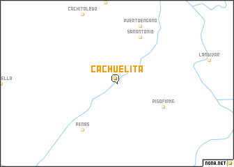
Cachuelita (Beni, Bolivia)Cachuelita is a town in the Beni region of Bolivia. An overview map of the region around Cachuelita is displayed below.
regional and 3d topo map of Cachuelita, Bolivia ::
Cachuelita airports ::
The nearest airport is BVH - Vilhena, located 225.3 km north east of Cachuelita.
Nearby towns ::
Piso Firme (8.1km south east) //
San Antonio (8.2km north east) //
Peñas (9.2km south west) //
[all distances 'as the bird flies' and approximate]  Places with similar names to Cachuelita, Bolivia ::
// Gacia Alto (ES)
// Gucialit (ID)
// Kachal Deh (IR)
// C. Chalate (MZ)
// Cachalot (CA)
// Kʼeshelʼta (GE)
// Gashult (SE)
// Gåshult (SE)
// Göshult (SE)
// Göshult (SE)
Disclaimer :: Information on this page comes without warranty of any kind |
||
|
Where is Cachuelita? Elevation and coordinates ::
Latitude (lat): 13°39'0"S Longitude (lon): 61°56'0"W
Elevation (approx.): 183m (map arrows pan, magnifying glasses zoom) |
||
|
Visiting Cachuelita? Hotel/Accommodation ::
Book a hotel in Cachuelita Travel Guide ::
Buy a travel guide for Bolivia rental cars ::
car rental offers GPS waypoint ::
download a GPX waypoint (PoI) of Cachuelita for your GPS receiver
|
||