|
search place name
|
||
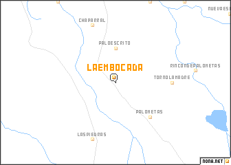
La Embocada (Santa Cruz, Bolivia)La Embocada is a town in the Santa Cruz region of Bolivia. An overview map of the region around La Embocada is displayed below.
regional and 3d topo map of La Embocada, Bolivia ::
La Embocada airports ::
The nearest airport is VVI - Santa Cruz Viru Viru Intl, located 86.4 km south east of La Embocada.
Nearby towns ::
Fangos (1.9km north) //
Palo Escrito (5.6km north) //
Palometas (7.7km south east) //
[all distances 'as the bird flies' and approximate] 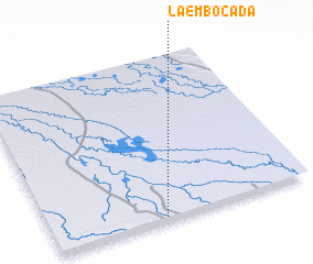 Places with similar names to La Embocada, Bolivia ::
// Lammagadi (ER)
// Lima Kedai (MY)
// Lumekete (CD)
// Loumbi Guido (SN)
// Leo Makoti (ZM)
// Līmākadeh (IR)
// La Maquete (HN)
// Lima Cota (PE)
// Limacota (PE)
// La Maguita (VE)
Disclaimer :: Information on this page comes without warranty of any kind |
||
|
Where is La Embocada? Elevation and coordinates ::
Latitude (lat): 16°59'0"S Longitude (lon): 63°34'0"W
Elevation (approx.): 229m (map arrows pan, magnifying glasses zoom) |
||
|
Visiting La Embocada? Hotel/Accommodation ::
Book a hotel in La Embocada Travel Guide ::
Buy a travel guide for Bolivia rental cars ::
car rental offers GPS waypoint ::
download a GPX waypoint (PoI) of La Embocada for your GPS receiver
|
||