|
search place name
|
||
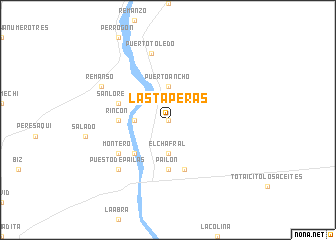
Las Taperas (Santa Cruz, Bolivia)Las Taperas is a town in the Santa Cruz region of Bolivia. An overview map of the region around Las Taperas is displayed below.
regional and 3d topo map of Las Taperas, Bolivia ::
Las Taperas airports ::
The nearest airport is VVI - Santa Cruz Viru Viru Intl, located 41.2 km west of Las Taperas.
Nearby towns ::
Puerto de la Cruz (0.0km north) //
El Chafral (3.7km south) //
Puerto Ancho (3.7km north) //
Curiche (3.5km west) //
El Pororó (5.1km south west) //
Rincón (5.3km west) //
Pailón (5.6km south) //
San Lorenzo (5.6km west) //
Totaicito (5.8km south) //
Montero (6.5km south west) //
Puerto Toledo (7.6km north) //
Puesto de Pailas (7.7km south west) //
Remanso (8.0km north west) //
[all distances 'as the bird flies' and approximate] 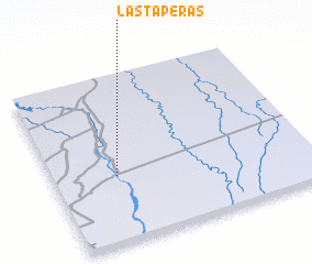 Places with similar names to Las Taperas, Bolivia ::
// Las Taparas (VE)
// Las Taparas (VE)
// Los Taparos (VE)
// Las Taparas (VE)
// Las Taparas (VE)
// Las Taperas (BO)
// Las Taperas (BO)
Disclaimer :: Information on this page comes without warranty of any kind |
||
|
Where is Las Taperas? Elevation and coordinates ::
Latitude (lat): 17°36'0"S Longitude (lon): 62°45'0"W
Elevation (approx.): 289m (map arrows pan, magnifying glasses zoom) |
||
|
Visiting Las Taperas? Hotel/Accommodation ::
Book a hotel in Las Taperas Travel Guide ::
Buy a travel guide for Bolivia rental cars ::
car rental offers GPS waypoint ::
download a GPX waypoint (PoI) of Las Taperas for your GPS receiver
|
||