|
search place name
|
||
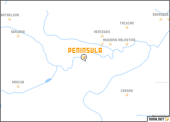
Península (Pando, Bolivia)Península is a town in the Pando region of Bolivia. An overview map of the region around Península is displayed below.
regional and 3d topo map of Península, Bolivia ::
Península airports ::
The nearest airport is RBR - Rio Branco Presidente Medici, located 150.9 km north west of Península.
Other airports nearby include CIJ - Cobija Heroes Del Acre (169.4 km west), PEM - Puerto Maldonado Padre Aldamiz (276.7 km south west), Nearby towns ::
Flor de Corazón (5.2km north east) //
Mercedes (6.6km north east) //
Medio Río (6.6km north east) //
[all distances 'as the bird flies' and approximate] 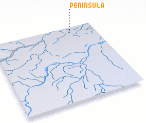 Places with similar names to Península, Bolivia ::
// Peñoncilla (PA)
// Peninsula (US)
// Pene-Nsali (CD)
// Península (HN)
// Peninsula (CA)
// Península (BO)
Disclaimer :: Information on this page comes without warranty of any kind |
||
|
Where is Península? Elevation and coordinates ::
Latitude (lat): 11°4'0"S Longitude (lon): 67°14'0"W
Elevation (approx.): 164m (map arrows pan, magnifying glasses zoom) |
||
|
Visiting Península? Hotel/Accommodation ::
Book a hotel in Península Travel Guide ::
Buy a travel guide for Bolivia rental cars ::
car rental offers GPS waypoint ::
download a GPX waypoint (PoI) of Península for your GPS receiver
|
||