|
search place name
|
||
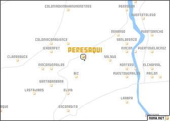
Peresaqui (Santa Cruz, Bolivia)Peresaqui is a town in the Santa Cruz region of Bolivia. An overview map of the region around Peresaqui is displayed below.
regional and 3d topo map of Peresaqui, Bolivia ::
Peresaqui airports ::
The nearest airport is VVI - Santa Cruz Viru Viru Intl, located 26.9 km west of Peresaqui.
Nearby towns ::
Biz (4.1km south west) //
Tocomechi (5.1km north west) //
Salado (5.3km east) //
Rincón de Pailas (7.3km west) //
Ichoenfet (7.3km west) //
El Vid (8.2km south west) //
Colonia Canadience (8.0km north west) //
Remanso (9.0km north east) //
Santa Bárbara (9.0km south west) //
[all distances 'as the bird flies' and approximate] 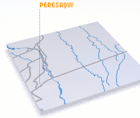 Places with similar names to Peresaqui, Bolivia ::
// Praia Sêca (BR)
// Prè-sawhku (MM)
// Prè-sawhku (MM)
// Parsch (AT)
// Prossegg (AT)
// Persico (US)
// Paarsch (DE)
// Preske (DE)
// Presseck (DE)
// Pressig (DE)
Disclaimer :: Information on this page comes without warranty of any kind |
||
|
Where is Peresaqui? Elevation and coordinates ::
Latitude (lat): 17°37'0"S Longitude (lon): 62°53'0"W
Elevation (approx.): 319m (map arrows pan, magnifying glasses zoom) |
||
|
Visiting Peresaqui? Hotel/Accommodation ::
Book a hotel in Peresaqui Travel Guide ::
Buy a travel guide for Bolivia rental cars ::
car rental offers GPS waypoint ::
download a GPX waypoint (PoI) of Peresaqui for your GPS receiver
|
||