|
search place name
|
||
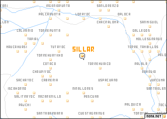
Sillar (Potosí, Bolivia)Sillar is a town in the Potosí region of Bolivia. An overview map of the region around Sillar is displayed below.
regional and 3d topo map of Sillar, Bolivia ::
Sillar airports ::
The nearest airport is TJA - Tarija Capitan Oriel Lea Plaza, located 120.3 km east of Sillar.
Other airports nearby include POI - Potosi Capitan Nicolas Rojas (206.0 km north), BJO - Bermejo (219.7 km south east), ORA - Oran (249.5 km south east), Nearby towns ::
Falsari (1.9km north) //
Tarcayoj (3.9km south east) //
Torrehuaico (3.9km south east) //
Tutayoc (5.5km west) //
Velacterapunta (6.5km north west) //
Torre Huaykho (6.9km west) //
Ollo (6.9km west) //
Niñallores (7.4km south) //
Cotaco (7.1km west) //
Uspacuano (7.6km south east) //
Celestecasa (7.8km south west) //
Cruz Casa (8.2km south west) //
Torrepunta (8.9km north west) //
Cotayoc (8.9km north west) //
Chacraloma (9.0km north east) //
Cabreria (8.9km south west) //
[all distances 'as the bird flies' and approximate] 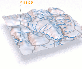 Places with similar names to Sillar, Bolivia ::
Disclaimer :: Information on this page comes without warranty of any kind |
||
|
Where is Sillar? Elevation and coordinates ::
Latitude (lat): 21°24'0"S Longitude (lon): 65°51'0"W
Elevation (approx.): 3960m (map arrows pan, magnifying glasses zoom) |
||
|
Visiting Sillar? Hotel/Accommodation ::
Book a hotel in Sillar Travel Guide ::
Buy a travel guide for Bolivia rental cars ::
car rental offers GPS waypoint ::
download a GPX waypoint (PoI) of Sillar for your GPS receiver
|
||