|
search place name
|
||
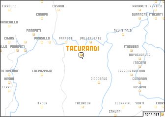
Tacurandi (Chuquisaca, Bolivia)Tacurandi is a town in the Chuquisaca region of Bolivia. An overview map of the region around Tacurandi is displayed below.
regional and 3d topo map of Tacurandi, Bolivia ::
Tacurandi airports ::
The nearest airport is TJA - Tarija Capitan Oriel Lea Plaza, located 174.5 km south west of Tacurandi.
Other airports nearby include BYC - Yacuiba (193.9 km south), SRE - Sucre Juana Azurduy De Padilla (204.4 km north west), POI - Potosi Capitan Nicolas Rojas (213.2 km west), Nearby towns ::
Vallefuerte (4.1km north east) //
Parapetí (5.1km north west) //
Pirarenda (6.6km south east) //
Las Arenas (7.9km north west) //
[all distances 'as the bird flies' and approximate] 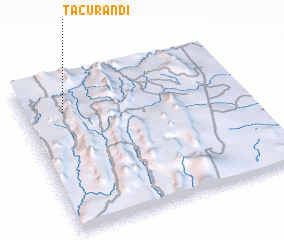 Places with similar names to Tacurandi, Bolivia ::
// Tacoronte (ES)
// Tokorondo (ID)
// Digurenda (PG)
// Taquarandi (BR)
// Tahkoranta (FI)
// Takkuranta (FI)
// Tacuarendí (AR)
// Tacuarandi (BO)
// Tacuarandi (BO)
// Tacuarandí (BO)
Disclaimer :: Information on this page comes without warranty of any kind |
||
|
Where is Tacurandi? Elevation and coordinates ::
Latitude (lat): 20°13'0"S Longitude (lon): 63°49'0"W
Elevation (approx.): 1032m (map arrows pan, magnifying glasses zoom) |
||
|
Visiting Tacurandi? Hotel/Accommodation ::
Book a hotel in Tacurandi Travel Guide ::
Buy a travel guide for Bolivia rental cars ::
car rental offers GPS waypoint ::
download a GPX waypoint (PoI) of Tacurandi for your GPS receiver
|
||