|
search place name
|
||
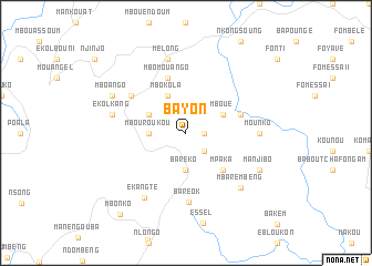
Bayon (Cameroon)Bayon is a town in Cameroon. An overview map of the region around Bayon is displayed below.
regional and 3d topo map of Bayon, Cameroon ::
Bayon airports ::
The nearest airport is BFX - Bafoussam, located 68.9 km north east of Bayon.
Other airports nearby include FOM - Foumban Nkounja (108.5 km north east), BPC - Bamenda (110.8 km north), DLA - Douala (118.7 km south), TKC - Tiko (125.7 km south west), Nearby towns ::
Eboukou (1.8km east) //
Soundop (2.6km south east) //
Bareko (3.7km south) //
Baré (3.7km south) //
Mbouroukou (3.7km west) //
Nlonkou (4.1km north west) //
Mbokola (4.1km north west) //
Mboué (4.1km north east) //
Nyabang (4.1km north west) //
Mpaka (5.2km south east) //
Mbomouango (5.9km north) //
Mboendang (5.9km north) //
Ekom Nkam (5.8km east) //
Ndidiang (6.7km north west) //
Baréok (7.0km south) //
Mounko (7.4km east) //
Ekolkang (7.6km west) //
Ngal (7.6km west) //
Melong (7.6km north) //
Ekangté (7.7km south west) //
Mbarembeng (7.8km south east) //
Manjibo (8.3km south east) //
Mboango (8.3km north west) //
Mbonko (10.5km south west) //
[all distances 'as the bird flies' and approximate] 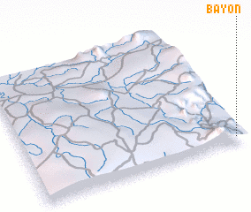 Places with similar names to Bayon, Cameroon ::
Disclaimer :: Information on this page comes without warranty of any kind |
||
|
Where is Bayon? Elevation and coordinates ::
Latitude (lat): 5°3'0"N Longitude (lon): 9°58'0"E
Elevation (approx.): 869m (map arrows pan, magnifying glasses zoom) |
||
|
Visiting Bayon? Hotel/Accommodation ::
Book a hotel in Bayon Travel Guide ::
Buy a travel guide for Cameroon rental cars ::
car rental offers GPS waypoint ::
download a GPX waypoint (PoI) of Bayon for your GPS receiver
|
||