|
search place name
|
||
Madara (Cameroon)Madara is a town in Cameroon. An overview map of the region around Madara is displayed below.
regional and 3d topo map of Madara, Cameroon ::

Madara airports ::
The nearest airport is GOU - Garoua, located 80.8 km south of Madara.
Other airports nearby include MVR - Maroua Salak (104.8 km north east), YOL - Yola (137.6 km south west), MIU - Maiduguri (200.6 km north), Nearby towns ::
Girviza (1.9km south) //
Mouéna (1.8km east) //
Bougouma (1.8km east) //
Mougoulounga (2.6km north west) //
Gimoulounga (2.6km north east) //
Tarnbaga (2.6km south west) //
Tororo (2.6km south west) //
Watchama (3.6km west) //
Goudé (3.6km west) //
Boutouza (3.6km west) //
Mouna (3.6km east) //
Donka (4.1km south west) //
Gindigina (4.1km north east) //
Mbouraba (4.1km south west) //
Désoukou (4.1km south east) //
Mapari (5.2km south west) //
Dirtcha (5.6km north) //
Kouafang (5.9km south) //
Kourngeun (5.9km south) //
Biri (5.9km north) //
Goungourga (5.8km east) //
Mouzouma (5.8km west) //
Dazal (5.9km south) //
Makirvé (6.6km north west) //
Gerhedjé (6.7km south west) //
Kintchaha (6.7km south west) //
Pokotchi (6.7km south east) //
koudoukoura (7.3km east) //
Kouadalang (7.3km east) //
[all distances 'as the bird flies' and approximate] 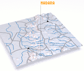 Places with similar names to Madara, Cameroon ::
Disclaimer :: Information on this page comes without warranty of any kind |
||
|
Where is Madara? Elevation and coordinates ::
Latitude (lat): 10°4'0"N Longitude (lon): 13°23'0"E
Elevation (approx.): 755m (map arrows pan, magnifying glasses zoom) |
||
|
Visiting Madara? Hotel/Accommodation ::
Book a hotel in Madara Travel Guide ::
Buy a travel guide for Cameroon rental cars ::
car rental offers GPS waypoint ::
download a GPX waypoint (PoI) of Madara for your GPS receiver
|
||