|
search place name
|
||
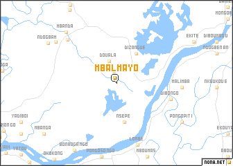
Mbalmayo (Littoral, Cameroon)Mbalmayo is a town in the Littoral region of Cameroon. An overview map of the region around Mbalmayo is displayed below.
regional and 3d topo map of Mbalmayo, Cameroon ::
Mbalmayo airports ::
The nearest airport is DLA - Douala, located 40.7 km north west of Mbalmayo.
Other airports nearby include TKC - Tiko (77.4 km north west), SSG - Malabo (138.5 km west), YAO - Yaounde Ville (174.7 km east), BSG - Bata (201.7 km south), Nearby towns ::
 Places with similar names to Mbalmayo, Cameroon ::
// Malumyaw (MM)
// Malomya (RU)
// Mulym'ya (RU)
// Mulym'ya (RU)
// Malemya (ZM)
// Mallam Boyi (NG)
// Malmayi (NG)
// Millimbaya (BO)
// Mollemayu (BO)
// Mbalmayo (CM)
Disclaimer :: Information on this page comes without warranty of any kind |
||
|
Where is Mbalmayo? Elevation and coordinates ::
Latitude (lat): 3°43'25"N Longitude (lon): 9°57'18"E
Elevation (approx.): 23m (map arrows pan, magnifying glasses zoom) |
||
|
Visiting Mbalmayo? Hotel/Accommodation ::
Book a hotel in Mbalmayo Travel Guide ::
Buy a travel guide for Cameroon rental cars ::
car rental offers GPS waypoint ::
download a GPX waypoint (PoI) of Mbalmayo for your GPS receiver
|
||