|
search place name
|
||
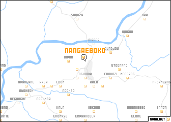
Nanga Eboko (Centre, Cameroon)Nanga Eboko is a town in the Centre region of Cameroon. An overview map of the region around Nanga Eboko is displayed below.
regional and 3d topo map of Nanga Eboko, Cameroon ::
Nanga Eboko airports ::
The nearest airport is YAO - Yaounde Ville, located 132.4 km south west of Nanga Eboko.
Other airports nearby include FOM - Foumban Nkounja (207.9 km north west), Nearby towns ::
Ekomba (2.6km south west) //
Nguinda (3.7km south) //
Bipan (3.7km west) //
Akak (4.1km south west) //
Bipoga (4.1km north east) //
Edoudoumwon (5.6km south) //
Wala (5.9km south) //
Boundjou (5.8km east) //
Kokoum (6.7km south east) //
Evounzi (6.7km south east) //
Etognang (7.6km east) //
Loum (7.8km south west) //
Ngamba (8.3km south west) //
Engane (9.2km south west) //
[all distances 'as the bird flies' and approximate] 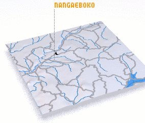 Places with similar names to Nanga Eboko, Cameroon ::
Disclaimer :: Information on this page comes without warranty of any kind |
||
|
Where is Nanga Eboko? Elevation and coordinates ::
Latitude (lat): 4°41'0"N Longitude (lon): 12°22'0"E
Elevation (approx.): 612m (map arrows pan, magnifying glasses zoom) |
||
|
Visiting Nanga Eboko? Hotel/Accommodation ::
Book a hotel in Nanga Eboko Travel Guide ::
Buy a travel guide for Cameroon rental cars ::
car rental offers GPS waypoint ::
download a GPX waypoint (PoI) of Nanga Eboko for your GPS receiver
|
||