|
search place name
|
||
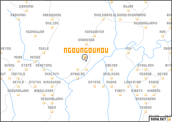
Ngoungoumou (Cameroon)Ngoungoumou is a town in Cameroon. An overview map of the region around Ngoungoumou is displayed below.
regional and 3d topo map of Ngoungoumou, Cameroon ::
Ngoungoumou airports ::
The nearest airport is YAO - Yaounde Ville, located 82.1 km north west of Ngoungoumou.
Other airports nearby include BMM - Bitam (145.7 km south west), OYE - Oyem (198.4 km south), Nearby towns ::
Mékak (1.9km south) //
Nkolfiti (2.6km south west) //
Énamenga (3.7km north) //
Éfoulan (4.1km south west) //
Enyeng (5.9km south) //
Kondébiyen (5.9km north) //
Ébézom (5.9km east) //
Biso (6.7km south east) //
Nkolésas (6.7km south east) //
Nkolyop (7.9km south east) //
Nkomo (7.9km south east) //
Nkolfiti (8.3km south west) //
Minkoumou (9.3km south west) //
Fibot I (10.5km south east) //
Angongé (10.5km south west) //
Nkilzok (10.5km north west) //
[all distances 'as the bird flies' and approximate] 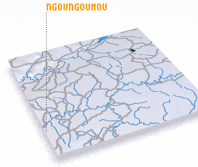 Places with similar names to Ngoungoumou, Cameroon ::
// Ngangam (CM)
// Nkone-Ekombe (CD)
// Ngungum (GQ)
// Ngoungoum (CM)
// Ngoungoum (CM)
// Ngoungoumou (CM)
// Ngoungoumou I (CM)
// Ngoungoumou II (CM)
// Nkankombo (CM)
// Nakano-kami (JP)
Disclaimer :: Information on this page comes without warranty of any kind |
||
|
Where is Ngoungoumou? Elevation and coordinates ::
Latitude (lat): 3°17'0"N Longitude (lon): 12°1'0"E
Elevation (approx.): 644m (map arrows pan, magnifying glasses zoom) |
||
|
Visiting Ngoungoumou? Hotel/Accommodation ::
Book a hotel in Ngoungoumou Travel Guide ::
Buy a travel guide for Cameroon rental cars ::
car rental offers GPS waypoint ::
download a GPX waypoint (PoI) of Ngoungoumou for your GPS receiver
|
||