|
search place name
|
||
Obokoé (Cameroon)Obokoé is a town in Cameroon. An overview map of the region around Obokoé is displayed below.
regional and 3d topo map of Obokoé, Cameroon ::

Obokoé airports ::
The nearest airport is YAO - Yaounde Ville, located 29.5 km north east of Obokoé.
Other airports nearby include BMM - Bitam (175.0 km south), DLA - Douala (183.5 km west), TKC - Tiko (224.4 km west), FOM - Foumban Nkounja (229.0 km north), Nearby towns ::
Ototomo (1.8km west) //
Osokoé (2.6km north east) //
Menyeng Adzap (2.6km north east) //
Nkongmeyos (4.1km south west) //
Koli (4.1km north west) //
Melen (5.6km north) //
Nkolemomodo (5.9km south) //
Bikolok (5.9km east) //
Bikoé I (5.9km east) //
Nkongdougou (6.7km south east) //
Méyila (6.7km south east) //
Nkolmesi (6.7km south east) //
Oveng (6.7km north east) //
Nkondougou I (7.4km east) //
Mbéyingé (7.6km north) //
Nkoakom (7.6km south) //
Nkolngok III (7.6km south) //
Zoasel I (7.6km east) //
Nkolngok (7.9km north east) //
Nkolmedzap (8.3km south west) //
Ngoumou (8.3km south west) //
Akono (8.3km north east) //
Yéné Yéné (9.3km south west) //
Eboloum (9.3km south west) //
Nkongabok I (9.3km north west) //
Abang II (9.3km south west) //
Bibé (10.5km north east) //
[all distances 'as the bird flies' and approximate] 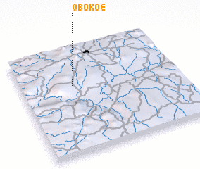 Places with similar names to Obokoé, Cameroon ::
Disclaimer :: Information on this page comes without warranty of any kind |
||
|
Where is Obokoé? Elevation and coordinates ::
Latitude (lat): 3°39'0"N Longitude (lon): 11°20'0"E
Elevation (approx.): 696m (map arrows pan, magnifying glasses zoom) |
||
|
Visiting Obokoé? Hotel/Accommodation ::
Book a hotel in Obokoé Travel Guide ::
Buy a travel guide for Cameroon rental cars ::
car rental offers GPS waypoint ::
download a GPX waypoint (PoI) of Obokoé for your GPS receiver
|
||