|
search place name
|
||
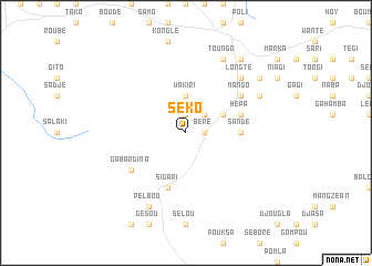
Séko (Cameroon)Séko is a town in Cameroon. An overview map of the region around Séko is displayed below.
regional and 3d topo map of Séko, Cameroon ::
Séko airports ::
The nearest airport is GOU - Garoua, located 107.0 km north of Séko.
Other airports nearby include NGE - N'gaoundere Ngaoundere (120.2 km south), YOL - Yola (128.5 km north west), Nearby towns ::
Boko (1.9km north) //
Ringo (1.9km north) //
Béré (1.8km east) //
Djogo (2.6km north east) //
Wakiri (3.7km north) //
Dongo (4.1km north east) //
Bakté (4.1km north east) //
Sandé (5.5km east) //
Sigari (5.9km south) //
Hépa (5.8km east) //
Gabardina (6.6km south west) //
Mango (6.6km north east) //
Mangati (6.6km north east) //
Pipa (6.6km north east) //
Longté (7.8km north east) //
Dai (7.8km north east) //
Pelbou (8.3km south west) //
Toungo (8.3km north east) //
Doumboulko (8.2km north east) //
Toukté (8.2km north east) //
Boundjé (9.2km north east) //
Sago (9.2km north east) //
Gata (9.2km north east) //
Saré (9.2km north east) //
[all distances 'as the bird flies' and approximate] 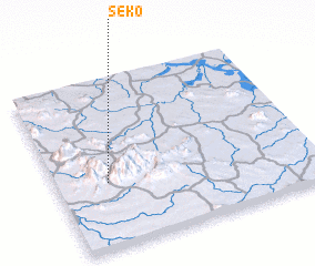 Places with similar names to Séko, Cameroon ::
Disclaimer :: Information on this page comes without warranty of any kind |
||
|
Where is Séko? Elevation and coordinates ::
Latitude (lat): 8°23'0"N Longitude (lon): 13°12'0"E
Elevation (approx.): 759m (map arrows pan, magnifying glasses zoom) |
||
|
Visiting Séko? Hotel/Accommodation ::
Book a hotel in Séko Travel Guide ::
Buy a travel guide for Cameroon rental cars ::
car rental offers GPS waypoint ::
download a GPX waypoint (PoI) of Séko for your GPS receiver
|
||