|
search place name
|
||
Sim (Cameroon)Sim is a town in Cameroon. An overview map of the region around Sim is displayed below.
regional and 3d topo map of Sim, Cameroon ::

Sim airports ::
The nearest airport is YAO - Yaounde Ville, located 52.4 km north east of Sim.
Other airports nearby include BMM - Bitam (154.4 km south), DLA - Douala (180.8 km west), OYE - Oyem (214.1 km south), TKC - Tiko (221.5 km west), Nearby towns ::
Lepsé (2.6km south west) //
Nkolnlong II (2.6km north west) //
Nkongnsam (3.7km north) //
Nkolnlong I (3.7km north) //
Olama (4.1km south east) //
Ekoudindi (5.2km south east) //
Osoébemva (5.6km south) //
Asok (5.6km south) //
Osoé Békada (5.5km west) //
Nkolnlong III (5.9km west) //
Mfida (5.9km east) //
Bikoukound (6.7km north west) //
Ekouméyek (7.4km south) //
Osoe Mékéning (7.4km south) //
Osoé Bikobo (7.4km west) //
Mévamébot (7.6km south) //
Bilik (8.3km north east) //
Mbing (8.3km north west) //
Loum (8.3km south east) //
Fegmimbang (9.3km north east) //
Onana Mbesa (9.3km south east) //
Nkolakono II (10.5km north east) //
Leblibong (10.5km north west) //
Fegmimbang (10.5km north east) //
[all distances 'as the bird flies' and approximate] 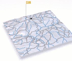 Places with similar names to Sim, Cameroon ::
Disclaimer :: Information on this page comes without warranty of any kind |
||
|
Where is Sim? Elevation and coordinates ::
Latitude (lat): 3°27'0"N Longitude (lon): 11°15'0"E
Elevation (approx.): 668m (map arrows pan, magnifying glasses zoom) |
||
|
Visiting Sim? Hotel/Accommodation ::
Book a hotel in Sim Travel Guide ::
Buy a travel guide for Cameroon rental cars ::
car rental offers GPS waypoint ::
download a GPX waypoint (PoI) of Sim for your GPS receiver
|
||