|
search place name
|
||
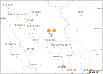
Uara (Eritrea)Uara is a town in Eritrea. An overview map of the region around Uara is displayed below.
regional and 3d topo map of Uara, Eritrea ::
Uara airports ::
The nearest airport is AXU - Axum, located 162.6 km south of Uara.
Nearby towns ::
Dekʼī Gebru (2.3km south) //
Digdig (3.9km south west) //
Gulgul (4.0km south) //
Dekʼemhāre Hāmasēn (5.3km south east) //
Ādī-Teklezan (5.5km south) //
Āgutrī (5.6km south west) //
Dildil (6.8km west) //
Habran Kʼakʼa (6.9km north west) //
Dekʼī Zer‘u (8.4km south) //
Ānseba (9.0km south west) //
Hayelo (9.1km north west) //
Kʼerechʼa (9.5km north west) //
Gurītat (10.2km south east) //
Hodīt (11.6km north west) //
[all distances 'as the bird flies' and approximate] 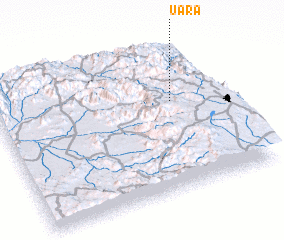 Places with similar names to Uara, Eritrea ::
Disclaimer :: Information on this page comes without warranty of any kind |
||
|
Where is Uara? Elevation and coordinates ::
Latitude (lat): 15°37'0"N Longitude (lon): 38°47'0"E
Elevation (approx.): 2291m (map arrows pan, magnifying glasses zoom) |
||
|
Visiting Uara? Hotel/Accommodation ::
Book a hotel in Uara Travel Guide ::
Buy a travel guide for Eritrea rental cars ::
car rental offers GPS waypoint ::
download a GPX waypoint (PoI) of Uara for your GPS receiver
|
||