|
search place name
|
||
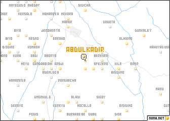
Ābdul Kʼadir (Ethiopia)Ābdul Kʼadir is a town in Ethiopia. An overview map of the region around Ābdul Kʼadir is displayed below.
regional and 3d topo map of Ābdul Kʼadir, Ethiopia ::
Ābdul Kʼadir airports ::
The nearest airport is DIR - Dire Dawa Intl, located 52.7 km north west of Ābdul Kʼadir.
Other airports nearby include HGA - Hargeisa Egal Intl (215.0 km east), Nearby towns ::
Mederu (0.0km north) //
Medero (1.9km south) //
Buru (2.6km south east) //
Bereser (3.7km east) //
Āfēzero (4.1km south east) //
Kʼalu (4.1km north east) //
Seroba (4.1km south east) //
Ārojī (5.8km west) //
Ērē Āwo (6.6km north west) //
Rarē Ībīcha (6.7km south west) //
Ābonyo (7.3km west) //
Kʼīlē (7.5km east) //
Dobīnē (7.5km west) //
Ādem Ābdulē (7.5km west) //
Hārer (8.3km north west) //
Ādem Lega (8.2km south west) //
Bīsīdīmo (8.2km south east) //
Jero Wenta (9.2km north west) //
Dodota (9.2km north east) //
[all distances 'as the bird flies' and approximate] 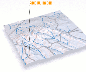 Places with similar names to Ābdul Kʼadir, Ethiopia ::
// Abdülkadir (TR)
// Abdull Qadīr (PK)
// Abd el Kader (MA)
// ‘Abd al Qādir (IQ)
// ‘Abd al Qādir (SD)
// Abd el Kader (MA)
Disclaimer :: Information on this page comes without warranty of any kind |
||
|
Where is Ābdul Kʼadir? Elevation and coordinates ::
Latitude (lat): 9°15'0"N Longitude (lon): 42°9'0"E
Elevation (approx.): 1784m (map arrows pan, magnifying glasses zoom) |
||
|
Visiting Ābdul Kʼadir? Hotel/Accommodation ::
Book a hotel in Ābdul Kʼadir Travel Guide ::
Buy a travel guide for Ethiopia rental cars ::
car rental offers GPS waypoint ::
download a GPX waypoint (PoI) of Ābdul Kʼadir for your GPS receiver
|
||