|
search place name
|
||
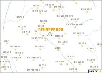
Demberbara (Ethiopia)Demberbara is a town in Ethiopia. An overview map of the region around Demberbara is displayed below.
regional and 3d topo map of Demberbara, Ethiopia ::
Demberbara airports ::
The nearest airport is AXU - Axum, located 52.3 km west of Demberbara.
Other airports nearby include MQX - Makale (89.0 km south), GDQ - Gondar (272.5 km south west), Nearby towns ::
Gunya (2.2km west) //
Āreteytī (2.5km south west) //
Ādī Fēla (3.0km east) //
Ādī Hagoda (3.9km west) //
Waʼira (4.6km north west) //
Ādī Ābeyto (5.1km west) //
May Temar (5.1km south east) //
Bēt Maryam (5.2km east) //
Āwagir (5.4km north west) //
Simchʼ (5.6km south east) //
Golgol (5.6km west) //
Ādī Hayem (5.8km south west) //
Ādī Gorandaʼitī (8.4km north east) //
Hinfilo (8.7km west) //
May Tsʼaʼida (9.0km south) //
Abuna Abiesghi (9.3km north west) //
Mikʼimatʼ Mekonin (9.2km north east) //
Ziban Hahayle (10.6km south west) //
Cocomet (10.8km south east) //
[all distances 'as the bird flies' and approximate] 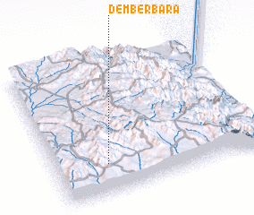 Places with similar names to Demberbara, Ethiopia :: Disclaimer :: Information on this page comes without warranty of any kind |
||
|
Where is Demberbara? Elevation and coordinates ::
Latitude (lat): 14°13'24"N Longitude (lon): 39°15'5"E
Elevation (approx.): 2355m (map arrows pan, magnifying glasses zoom) |
||
|
Visiting Demberbara? Hotel/Accommodation ::
Book a hotel in Demberbara Travel Guide ::
Buy a travel guide for Ethiopia rental cars ::
car rental offers GPS waypoint ::
download a GPX waypoint (PoI) of Demberbara for your GPS receiver
|
||