|
search place name
|
||
Gedam Ā‘imro (Ethiopia)Gedam Ā‘imro is a town in Ethiopia. An overview map of the region around Gedam Ā‘imro is displayed below.
regional and 3d topo map of Gedam Ā‘imro, Ethiopia ::

Gedam Ā‘imro airports ::
The nearest airport is ADD - Addis Ababa Bole Intl, located 76.3 km south east of Gedam Ā‘imro.
Other airports nearby include JIM - Jimma (283.0 km south west), Nearby towns ::
Shebelī (1.9km north) //
Āla (3.7km south) //
Ējersa Jara (3.7km north) //
Ābotē (4.1km south east) //
Yaya Haro (4.1km north west) //
Mechʼota (4.1km north west) //
Kʼemetʼē (4.1km north west) //
Odo Āgemso (4.1km north east) //
Ārērē (5.2km south east) //
Lankʼīsa (5.6km north) //
Burunkʼo (5.8km east) //
Tulu Menkīcho (5.9km south) //
Jogola (5.9km north) //
Dīde Telba (5.9km north) //
Ine Gofo (6.6km south west) //
Dīkiftu (6.7km south west) //
Wilī (6.7km south west) //
Wachʼu (6.7km south west) //
Sīlīmo (6.7km north east) //
Denjo (7.3km east) //
Kedany Āmba (7.5km east) //
Ālī Dēra (7.5km east) //
Sokoro (7.6km north) //
Dirē (7.8km north east) //
Chʼekʼorsa (8.2km south west) //
Motʼowa (8.2km north east) //
Salayish (8.3km north east) //
Kʼerīya (8.3km north west) //
Chʼefē Hawiy (9.2km south west) //
[all distances 'as the bird flies' and approximate] 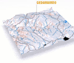 Places with similar names to Gedam Ā‘imro, Ethiopia :: Disclaimer :: Information on this page comes without warranty of any kind |
||
|
Where is Gedam Ā‘imro? Elevation and coordinates ::
Latitude (lat): 9°36'0"N Longitude (lon): 38°30'0"E
Elevation (approx.): 2036m (map arrows pan, magnifying glasses zoom) |
||
|
Visiting Gedam Ā‘imro? Hotel/Accommodation ::
Book a hotel in Gedam Ā‘imro Travel Guide ::
Buy a travel guide for Ethiopia rental cars ::
car rental offers GPS waypoint ::
download a GPX waypoint (PoI) of Gedam Ā‘imro for your GPS receiver
|
||