|
search place name
|
||
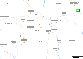
Gherebela (Ethiopia)Gherebela is a town in Ethiopia. An overview map of the region around Gherebela is displayed below.
regional and 3d topo map of Gherebela, Ethiopia ::
Gherebela airports ::
The nearest airport is AXU - Axum, located 18.1 km north east of Gherebela.
Other airports nearby include MQX - Makale (118.8 km south east), GDQ - Gondar (214.6 km south west), Nearby towns ::
Ātsʼmī Harmaz (3.3km south west) //
Ādī Īyo (3.6km south east) //
Kiwadat (3.9km north east) //
Hambera (4.7km west) //
Āwzēna (4.9km south west) //
Kuʼīla (5.8km south west) //
Dura (5.9km north) //
Ādī Hangī (5.8km north west) //
Ādī Guʼī (5.9km east) //
Imbaza (6.3km south) //
Wikʼro (6.5km north west) //
Ādī Hankera (7.1km north east) //
Ādī Gīyorgīs (7.2km west) //
Barkwa (8.8km north west) //
Dimbaza (8.8km south west) //
Wikʼro (8.9km north west) //
Ferīma (9.5km south west) //
Hauista (10.1km south east) //
[all distances 'as the bird flies' and approximate] 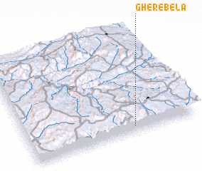 Places with similar names to Gherebela, Ethiopia ::
// Virbalai (LT)
// Varbla (EE)
// Varbola (EE)
// Vărbila (RO)
// Vărbilău (RO)
// Vărbilău (RO)
// Verble (US)
// Furibalia (SL)
// Ghari Bala (PK)
// Ghari Bāla (PK)
Disclaimer :: Information on this page comes without warranty of any kind |
||
|
Where is Gherebela? Elevation and coordinates ::
Latitude (lat): 14°4'12"N Longitude (lon): 38°37'29"E
Elevation (approx.): 2333m (map arrows pan, magnifying glasses zoom) |
||
|
Visiting Gherebela? Hotel/Accommodation ::
Book a hotel in Gherebela Travel Guide ::
Buy a travel guide for Ethiopia rental cars ::
car rental offers GPS waypoint ::
download a GPX waypoint (PoI) of Gherebela for your GPS receiver
|
||