|
search place name
|
||
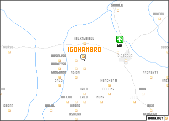
Īgo Hāmbro (Ethiopia)Īgo Hāmbro is a town in Ethiopia. An overview map of the region around Īgo Hāmbro is displayed below.
regional and 3d topo map of Īgo Hāmbro, Ethiopia ::
Īgo Hāmbro airports ::
The nearest airport is DIR - Dire Dawa Intl, located 9.0 km north east of Īgo Hāmbro.
Nearby towns ::
Halo Hula Yesuf (1.9km south) //
Dujuma (1.9km south) //
Melka Jebdu (1.8km west) //
Sedēkʼo (2.6km south west) //
Melka Jebdu (3.7km north) //
Gololcha (4.1km south west) //
Ādīga (4.1km south west) //
Haselīso (5.5km west) //
Dirē Jara (5.5km west) //
Hīndēysa (5.8km west) //
Dirē Jara (6.6km south west) //
Halo (7.4km south) //
Sabīyan (7.5km east) //
Kʼenchʼera (7.8km south east) //
Kʼorenchʼatī (7.8km south west) //
Dalo (7.8km south west) //
Felema (9.2km south east) //
[all distances 'as the bird flies' and approximate] 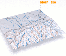 Places with similar names to Īgo Hāmbro, Ethiopia :: Disclaimer :: Information on this page comes without warranty of any kind |
||
|
Where is Īgo Hāmbro? Elevation and coordinates ::
Latitude (lat): 9°35'0"N Longitude (lon): 41°47'0"E
Elevation (approx.): 1266m (map arrows pan, magnifying glasses zoom) |
||
|
Visiting Īgo Hāmbro? Hotel/Accommodation ::
Book a hotel in Īgo Hāmbro Travel Guide ::
Buy a travel guide for Ethiopia rental cars ::
car rental offers GPS waypoint ::
download a GPX waypoint (PoI) of Īgo Hāmbro for your GPS receiver
|
||