|
search place name
|
||
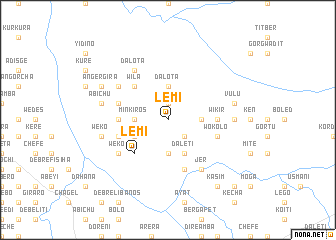
Lemī (Ethiopia)Lemī is a town in Ethiopia. An overview map of the region around Lemī is displayed below.
regional and 3d topo map of Lemī, Ethiopia ::
Lemī airports ::
The nearest airport is ADD - Addis Ababa Bole Intl, located 91.8 km south of Lemī.
Other airports nearby include BJR - Bahar Dar Bahir Dar (265.4 km north west), Nearby towns ::
Salayish (1.9km north) //
Mene Ona (2.6km south east) //
Kokeb Mesk (3.7km north) //
Dalota (3.7km north) //
Kabī (3.7km north) //
Dembī (3.7km south) //
Dereku (3.7km east) //
Selēla (3.7km west) //
Minkʼīros (3.7km west) //
Daletī (4.1km south east) //
Wijiba (4.1km south west) //
Girgir (5.2km north west) //
Wila (5.2km north west) //
Lemī (5.2km south west) //
Welbatī (5.5km west) //
Gosh Wiha (5.5km east) //
Wikʼir (5.5km east) //
Girargē (5.9km south) //
Wenedī (5.8km west) //
Wokʼolo (5.8km east) //
Sekoro (5.8km west) //
Weren Chʼefē (5.8km west) //
Geza Washa (6.6km north west) //
Weko (6.6km south west) //
Jer (6.7km south east) //
Dalota (6.7km north west) //
Kʼulkʼwal (7.3km east) //
Vulu (7.5km east) //
Ābīchu (7.5km west) //
[all distances 'as the bird flies' and approximate] 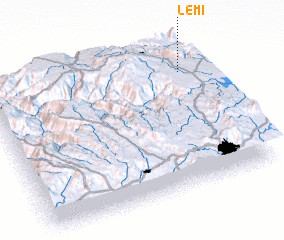 Places with similar names to Lemī, Ethiopia ::
Disclaimer :: Information on this page comes without warranty of any kind |
||
|
Where is Lemī? Elevation and coordinates ::
Latitude (lat): 9°48'0"N Longitude (lon): 38°55'0"E
Elevation (approx.): 2643m (map arrows pan, magnifying glasses zoom) |
||
|
Visiting Lemī? Hotel/Accommodation ::
Book a hotel in Lemī Travel Guide ::
Buy a travel guide for Ethiopia rental cars ::
car rental offers GPS waypoint ::
download a GPX waypoint (PoI) of Lemī for your GPS receiver
|
||