|
search place name
|
||
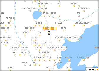
Shambu (Welega, Ethiopia)Shambu is a town in the Welega region of Ethiopia. An overview map of the region around Shambu is displayed below.
regional and 3d topo map of Shambu, Ethiopia ::
Shambu airports ::
The nearest airport is ADD - Addis Ababa Bole Intl, located 197.7 km east of Shambu.
Other airports nearby include JIM - Jimma (212.5 km south), Nearby towns ::
Leku (3.7km west) //
Chʼaltē (4.1km south east) //
Līmu (4.1km north west) //
Senkʼolē (4.1km south west) //
Tʼēno (4.1km south west) //
Chʼeber (5.2km north east) //
Chʼabir (5.2km north west) //
Ābē Buko (5.2km south west) //
Doyo (5.8km east) //
Harbu Bala (5.9km south) //
Rob Gebeya (5.9km south) //
Gītīlo (5.8km west) //
Doshē (6.7km south west) //
Dulecha (6.7km south west) //
Kʼeraru (6.7km south west) //
Rīfentī (6.6km north west) //
Gītīlo (6.6km south west) //
Keta Shunkura (7.4km north) //
Tulu Neboyē (7.6km north) //
Guleccia (7.5km west) //
Merechʼo (7.5km east) //
Tulu Debēsa (7.6km south) //
Kʼītʼība (7.8km south east) //
Sebet (8.3km north east) //
[all distances 'as the bird flies' and approximate] 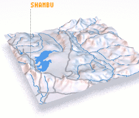 Places with similar names to Shambu, Ethiopia ::
Disclaimer :: Information on this page comes without warranty of any kind |
||
|
Where is Shambu? Elevation and coordinates ::
Latitude (lat): 9°34'0"N Longitude (lon): 37°6'0"E
Elevation (approx.): 2575m (map arrows pan, magnifying glasses zoom) |
||
|
Visiting Shambu? Hotel/Accommodation ::
Book a hotel in Shambu Travel Guide ::
Buy a travel guide for Ethiopia rental cars ::
car rental offers GPS waypoint ::
download a GPX waypoint (PoI) of Shambu for your GPS receiver
|
||