|
search place name
|
||
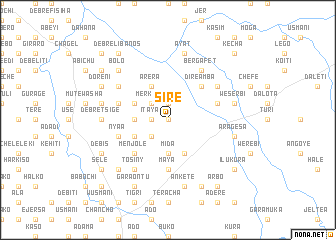
Sirē (Ethiopia)Sirē is a town in Ethiopia. An overview map of the region around Sirē is displayed below.
regional and 3d topo map of Sirē, Ethiopia ::
Sirē airports ::
The nearest airport is ADD - Addis Ababa Bole Intl, located 75.4 km south of Sirē.
Other airports nearby include BJR - Bahar Dar Bahir Dar (278.2 km north west), Nearby towns ::
Wertʼu (0.0km north) //
Sebro (1.9km north) //
Ītaya (1.8km west) //
Merkʼeta (2.6km north west) //
Wertʼu (2.6km south west) //
Goro (3.7km south) //
Mīda (3.7km south) //
Kʼurēmanyo (3.7km west) //
Sertʼē (3.7km west) //
Mekīcho (3.7km west) //
Jebanē (4.1km south east) //
Maya (4.1km north west) //
Ārēra (4.1km north west) //
Tulu Geda (4.1km south west) //
Jibo (4.1km north west) //
Fentalē (4.1km north west) //
Dirē Āmba (5.2km north east) //
Yifechʼ (5.2km north east) //
Goro (5.2km south west) //
Menjolē (5.2km south west) //
Wertʼu (5.6km south) //
Maya (5.6km south) //
Galmo (5.8km east) //
Nyaʼā (5.8km west) //
Misrakʼē (5.8km west) //
Mutʼē (6.6km north west) //
Kʼasīm (6.6km north east) //
Terara (6.6km north west) //
Bergafet (6.7km north east) //
[all distances 'as the bird flies' and approximate]  Places with similar names to Sirē, Ethiopia ::
Disclaimer :: Information on this page comes without warranty of any kind |
||
|
Where is Sirē? Elevation and coordinates ::
Latitude (lat): 9°39'0"N Longitude (lon): 38°55'0"E
Elevation (approx.): 2620m (map arrows pan, magnifying glasses zoom) |
||
|
Visiting Sirē? Hotel/Accommodation ::
Book a hotel in Sirē Travel Guide ::
Buy a travel guide for Ethiopia rental cars ::
car rental offers GPS waypoint ::
download a GPX waypoint (PoI) of Sirē for your GPS receiver
|
||