|
search place name
|
||
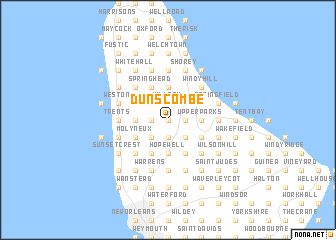
Dunscombe (Saint Thomas, Barbados)Dunscombe is a town in the Saint Thomas region of Barbados. An overview map of the region around Dunscombe is displayed below.
regional and 3d topo map of Dunscombe, Barbados ::
Dunscombe airports ::
The nearest airport is BGI - Bridgetown Grantley Adams Intl, located 17.0 km south east of Dunscombe.
Other airports nearby include UVF - Hewandorra Hewanorra Intl (159.6 km west), SVD - Kingstown E T Joshua (176.5 km west), MQS - Mustique (176.6 km west), SLU - Castries George F L Charles (177.5 km north west), Nearby towns ::
Canefield (0.0km north) //
Farmers (0.0km north) //
Sturges (1.8km east) //
Bloomsbury (1.8km east) //
Fruitful Hill (1.8km east) //
White Hill (1.8km east) //
Lion Castle Tenantry (1.9km south) //
Hillaby (1.9km north) //
Dukes (1.9km south) //
Gregg Farm (1.9km north) //
Plumtree (1.8km west) //
Orange Hill (1.8km west) //
Endeavour (1.8km west) //
Hoytes (2.6km north east) //
Baxters (2.6km north east) //
Mount Wilton (2.6km south east) //
Coles Cave (2.6km south east) //
Allen View (2.6km south east) //
Carrington (2.6km south east) //
Chapman (2.6km south east) //
Welchman Hall (2.6km south east) //
Rock Hall (2.6km south west) //
Poreys Spring (2.6km south west) //
Apes Hill (2.6km north west) //
Endeavour (3.7km south) //
Hopewell (3.7km south) //
Vaucluse Factory (3.7km south) //
Swanns (3.7km north) //
Turners Hall (3.7km north) //
[all distances 'as the bird flies' and approximate]  Places with similar names to Dunscombe, Barbados :: Disclaimer :: Information on this page comes without warranty of any kind |
||
|
Where is Dunscombe? Elevation and coordinates ::
Latitude (lat): 13°12'0"N Longitude (lon): 59°35'0"W
Elevation (approx.): 259m (map arrows pan, magnifying glasses zoom) |
||
|
Visiting Dunscombe? Hotel/Accommodation ::
Book a hotel in Dunscombe Travel Guide ::
Buy a travel guide for Barbados rental cars ::
car rental offers GPS waypoint ::
download a GPX waypoint (PoI) of Dunscombe for your GPS receiver
|
||