|
search place name
|
||
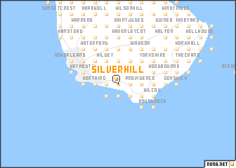
Silver Hill (Christ Church, Barbados)Silver Hill is a town in the Christ Church region of Barbados. An overview map of the region around Silver Hill is displayed below.
regional and 3d topo map of Silver Hill, Barbados ::
Silver Hill airports ::
The nearest airport is BGI - Bridgetown Grantley Adams Intl, located 6.3 km east of Silver Hill.
Other airports nearby include UVF - Hewandorra Hewanorra Intl (168.9 km north west), MQS - Mustique (178.0 km west), SVD - Kingstown E T Joshua (180.3 km west), SLU - Castries George F L Charles (188.5 km north west), Nearby towns ::
Sheraton Park (0.0km north) //
Maxwell Coast (0.0km north) //
Kendal Hill (0.0km north) //
Maxwell (0.0km north) //
Kent (1.9km north) //
Saint Davids (1.9km north) //
Gall Hill (1.8km east) //
Oistins (1.8km east) //
Lodge Road (1.8km east) //
Montrose (1.8km east) //
Wotton (1.8km east) //
Newton Terrace (1.8km east) //
Welches (1.9km south) //
Top Rock (1.8km west) //
Warners (1.8km west) //
Maxwell Hill (1.8km west) //
Durants (2.6km north east) //
Bannatyne (2.6km north east) //
Kingsland (2.6km north east) //
Edey (2.6km north east) //
Sargeant (2.6km north west) //
Regency Park (2.6km north west) //
Graeme Hall (2.6km north west) //
Elizabeth Park (2.6km north west) //
Vauxhall (2.6km north west) //
Scarborough (2.6km south east) //
Cane Vale (2.6km south east) //
Kelzer Hill (2.6km south east) //
Gibbons Boggs (2.6km south east) //
[all distances 'as the bird flies' and approximate] 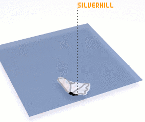 Places with similar names to Silver Hill, Barbados ::
// Silverhill (US)
// Silver Hill (US)
// Silver Hill (US)
// Silver Hill (US)
// Silverhill (US)
// Silver Hill (US)
// Silver Hill (US)
// Silver Hill (US)
// Silver Hill (US)
// Silver Hill (US)
Disclaimer :: Information on this page comes without warranty of any kind |
||
|
Where is Silver Hill? Elevation and coordinates ::
Latitude (lat): 13°4'0"N Longitude (lon): 59°33'0"W
Elevation (approx.): 10m (map arrows pan, magnifying glasses zoom) |
||
|
Visiting Silver Hill? Hotel/Accommodation ::
Book a hotel in Silver Hill Travel Guide ::
Buy a travel guide for Barbados rental cars ::
car rental offers GPS waypoint ::
download a GPX waypoint (PoI) of Silver Hill for your GPS receiver
|
||