|
search place name
|
||
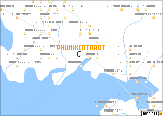
Phumĭ Kon Tnaôt (Siĕm Réab, Cambodia)Phumĭ Kon Tnaôt is a town in the Siĕm Réab region of Cambodia. An overview map of the region around Phumĭ Kon Tnaôt is displayed below.
regional and 3d topo map of Phumĭ Kon Tnaôt, Cambodia ::
Phumĭ Kon Tnaôt airports ::
The nearest airport is REP - Siem-reap Siem Reap, located 75.7 km north west of Phumĭ Kon Tnaôt.
Other airports nearby include PNH - Phnom-penh Phnom Penh Intl (174.5 km south), Nearby towns ::
Phumĭ Ta Pôr Kraôm (1.9km north) //
Phumĭ Knŏng (1.8km east) //
Phumĭ Kbal Duŏch (1.9km south) //
Phumĭ Châmbák Kântrom (2.6km north east) //
Phumĭ Spéan Tnaôt (2.6km north west) //
Phumĭ Balăng (2.6km south west) //
Phumĭ Ta Nguŏn (3.6km east) //
Phumĭ Bœ̆ng Trâmaôl (3.6km east) //
Phumĭ Lvêng Rœssei (4.1km north east) //
Phumĭ Rung (5.2km north east) //
Phumĭ Kngan Pông (5.4km west) //
Phumĭ Rumdéng (5.4km west) //
Phumĭ O Phlŏng (5.6km north) //
Phumĭ Thmei (1) (5.8km north) //
Phumĭ Ta Pôr Leu (7.4km north) //
Phumĭ Ta Yŭn (7.2km west) //
Phumĭ Ph'av (7.6km north) //
Phumĭ Lvéay (8.1km south east) //
Kâmpóng Kdei (9.1km north west) //
Phumĭ Trach Thmei (10.3km north west) //
[all distances 'as the bird flies' and approximate]  Places with similar names to Phumĭ Kon Tnaôt, Cambodia ::
// Phumĭ Kon Tnaôt (KH)
Disclaimer :: Information on this page comes without warranty of any kind |
||
|
Where is Phumĭ Kon Tnaôt? Elevation and coordinates ::
Latitude (lat): 13°4'0"N Longitude (lon): 104°25'0"E
Elevation (approx.): 13m (map arrows pan, magnifying glasses zoom) |
||
|
Visiting Phumĭ Kon Tnaôt? Hotel/Accommodation ::
Book a hotel in Phumĭ Kon Tnaôt Travel Guide ::
Buy a travel guide for Cambodia rental cars ::
car rental offers GPS waypoint ::
download a GPX waypoint (PoI) of Phumĭ Kon Tnaôt for your GPS receiver
|
||