|
search place name
|
||
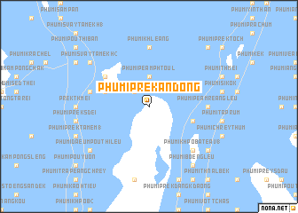
Phumĭ Prêk Ândong (Bântéay Méan Cheăy, Cambodia)Phumĭ Prêk Ândong is a town in the Bântéay Méan Cheăy region of Cambodia. An overview map of the region around Phumĭ Prêk Ândong is displayed below.
regional and 3d topo map of Phumĭ Prêk Ândong, Cambodia ::
Phumĭ Prêk Ândong airports ::
The nearest airport is PNH - Phnom-penh Phnom Penh Intl, located 58.1 km north west of Phumĭ Prêk Ândong.
Other airports nearby include SGN - Ho Chi Minh City Tansonnhat Intl (167.4 km east), Nearby towns ::
Phumĭ Sâmraông (2.6km north west) //
Phumĭ Péam Phtoŭl (3.7km north) //
Phumĭ Prêk Rœssei (5.8km west) //
Phumĭ Péam Reăng Kraôm (5.8km east) //
Phumĭ Lvéa Toŭng (6.6km north west) //
Phumĭ Khleăng (7.4km north) //
Phumĭ Péam Reăng Leu (7.3km east) //
Phumĭ Kâmpóng Kŏng (7.5km west) //
Phumĭ Khpôb A Téav (1) (7.8km south east) //
Phumĭ Bœ̆ng Leu (9.2km south east) //
Phumĭ Kaôh Chék (9.2km south east) //
Phumĭ Daeum Poŭthĭ Leu (9.2km south west) //
Phumĭ Svay Ta Mékh (2) (9.2km north west) //
Phumĭ Prêk Dăch (10.4km north east) //
[all distances 'as the bird flies' and approximate] 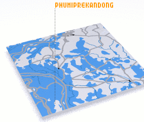 Places with similar names to Phumĭ Prêk Ândong, Cambodia ::
// Phumĭ Prey Kândiĕng (KH)
Disclaimer :: Information on this page comes without warranty of any kind |
||
|
Where is Phumĭ Prêk Ândong? Elevation and coordinates ::
Latitude (lat): 11°7'0"N Longitude (lon): 105°9'0"E
Elevation (approx.): 5m (map arrows pan, magnifying glasses zoom) |
||
|
Visiting Phumĭ Prêk Ândong? Hotel/Accommodation ::
Book a hotel in Phumĭ Prêk Ândong Travel Guide ::
Buy a travel guide for Cambodia rental cars ::
car rental offers GPS waypoint ::
download a GPX waypoint (PoI) of Phumĭ Prêk Ândong for your GPS receiver
|
||