|
search place name
|
||
Phumĭ Prey Sraông (Kâmpóng Spœ, Cambodia)Phumĭ Prey Sraông is a town in the Kâmpóng Spœ region of Cambodia. An overview map of the region around Phumĭ Prey Sraông is displayed below.
regional and 3d topo map of Phumĭ Prey Sraông, Cambodia ::

Phumĭ Prey Sraông airports ::
The nearest airport is PNH - Phnom-penh Phnom Penh Intl, located 60.5 km north east of Phumĭ Prey Sraông.
Nearby towns ::
Phumĭ Prey Chrey (1.9km south) //
Phumĭ Âmpŏu Chăs (1.8km east) //
Phumĭ Thmei (4) (2.6km north west) //
Phumĭ Thlôk Préch (2.6km north east) //
Phumĭ Dâmnăk Trach (3.7km south) //
Phumĭ Rôluŏs (3.6km east) //
Srê Khlŏng (4.1km south west) //
Phumĭ Srŏk Chék (4.1km north west) //
Phumĭ Âmpŏu Thmei (4.1km south east) //
Phumĭ Prey Preăh Srŏk (5.2km north east) //
Phumĭ Krăng Ta Thér (5.8km north) //
Phumĭ Kântéh Láng (6.6km south west) //
Phumĭ Prey Rômiĕt (6.6km north west) //
Phumĭ Tœ̆k Chénh (1) (6.6km north west) //
Phumĭ Lâ (6.6km south west) //
Phumĭ Mŭk Phŏh (6.6km north east) //
Tăng Srâlau (7.8km north east) //
Phumĭ Krăng Khvav (7.8km north east) //
Phumĭ Péam Hov (8.3km south west) //
Phumĭ Prŭm Rôlôk (8.3km north east) //
Phumĭ Kbal Tœ̆k (9.2km south east) //
[all distances 'as the bird flies' and approximate] 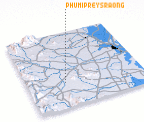 Places with similar names to Phumĭ Prey Sraông, Cambodia :: Disclaimer :: Information on this page comes without warranty of any kind |
||
|
Where is Phumĭ Prey Sraông? Elevation and coordinates ::
Latitude (lat): 11°20'0"N Longitude (lon): 104°20'0"E
Elevation (approx.): 71m (map arrows pan, magnifying glasses zoom) |
||
|
Visiting Phumĭ Prey Sraông? Hotel/Accommodation ::
Book a hotel in Phumĭ Prey Sraông Travel Guide ::
Buy a travel guide for Cambodia rental cars ::
car rental offers GPS waypoint ::
download a GPX waypoint (PoI) of Phumĭ Prey Sraông for your GPS receiver
|
||