|
search place name
|
||
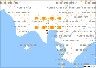
Phumĭ Srângam (Kâmpôt, Cambodia)Phumĭ Srângam is a town in the Kâmpôt region of Cambodia. An overview map of the region around Phumĭ Srângam is displayed below.
regional and 3d topo map of Phumĭ Srângam, Cambodia ::
Phumĭ Srângam airports ::
The nearest airport is PNH - Phnom-penh Phnom Penh Intl, located 127.2 km north of Phumĭ Srângam.
Nearby towns ::
Phumĭ Véal Taping (2.6km south east) //
Phumĭ Ângkoŭl (2.6km south west) //
Phumĭ Âmpêng (2.6km north west) //
Phumĭ Srângam (3.7km north) //
Phumĭ Sla Ta Aôn (4.1km south east) //
Phumĭ Phnum Léav (4.1km north west) //
Phumĭ Bay Téa (5.2km north east) //
Phumĭ Khvav (5.2km north west) //
Phumĭ Svay Tông (5.5km east) //
Phumĭ Châmkar Chék (5.6km north) //
Phumĭ Trâpeăng Niĕl (5.8km east) //
Phumĭ Trung Ândaeuk (5.9km north) //
Phumĭ Pông Tœ̆k (5.9km north) //
Phumĭ Lôk (6.6km south east) //
Phumĭ Kândal Tuŏl (7.6km north) //
Phumĭ Thnóng (7.5km east) //
Phumĭ Kâmpul Méas (7.5km east) //
Phumĭ Prêk Chak (7.8km south east) //
Phumĭ Prey Srâmaôch (8.3km north west) //
Phumĭ Kaôh Ta Chăn (8.2km north east) //
Phumĭ Krâsăng (8.2km north west) //
Xóm Xa Xía (9.2km south east) //
Phumĭ Kaôh Tônsay (9.2km south west) //
Phumĭ Tnaôt (9.2km north east) //
Xóm Xa Kỳ (10.4km south east) //
Phumĭ Kaôh Khlot (10.4km north east) //
[all distances 'as the bird flies' and approximate] 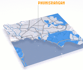 Places with similar names to Phumĭ Srângam, Cambodia ::
// Phumĭ Srângam (KH)
// Phumĭ Srângam (KH)
Disclaimer :: Information on this page comes without warranty of any kind |
||
|
Where is Phumĭ Srângam? Elevation and coordinates ::
Latitude (lat): 10°29'0"N Longitude (lon): 104°24'0"E
Elevation (approx.): 3m (map arrows pan, magnifying glasses zoom) |
||
|
Visiting Phumĭ Srângam? Hotel/Accommodation ::
Book a hotel in Phumĭ Srângam Travel Guide ::
Buy a travel guide for Cambodia rental cars ::
car rental offers GPS waypoint ::
download a GPX waypoint (PoI) of Phumĭ Srângam for your GPS receiver
|
||