|
search place name
|
||
Phumĭ Srê Prăng (Siĕm Réab, Cambodia)Phumĭ Srê Prăng is a town in the Siĕm Réab region of Cambodia. An overview map of the region around Phumĭ Srê Prăng is displayed below.
regional and 3d topo map of Phumĭ Srê Prăng, Cambodia ::

Phumĭ Srê Prăng airports ::
The nearest airport is REP - Siem-reap Siem Reap, located 44.8 km south of Phumĭ Srê Prăng.
Other airports nearby include NAK - Nakhon Ratchasima Khorat (215.3 km north west), Nearby towns ::
Phumĭ Toch (1.8km east) //
Phumĭ Kâmbaô (2.6km south east) //
Phumĭ Ândăs (2.6km south east) //
Phumĭ Rôlum (2.6km south east) //
Phumĭ Char (3.6km east) //
Phumĭ Ântŭng (4.0km south west) //
Phumĭ Kântuŏt (5.2km north west) //
Rœssei Thum (5.4km east) //
Phumĭ Don Pénh (5.6km south) //
Ban Ra Lom Tim (5.7km west) //
Phumĭ Tŭm Tĭn (6.6km north east) //
Phumĭ Koŭk Knŏng (6.6km south west) //
Phumĭ O (7.2km east) //
Phumĭ Paôy Ta Prăk (7.4km south) //
Phumĭ Slat (7.4km west) //
Phumĭ Chŭmrum Réach (8.1km south west) //
Phumĭ Bat (8.2km south west) //
Phumĭ Prasat (9.2km south west) //
Phumĭ Koŭl (9.2km south west) //
[all distances 'as the bird flies' and approximate] 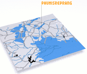 Places with similar names to Phumĭ Srê Prăng, Cambodia ::
// Phumĭ Srê Prăng (KH)
// Phumĭ Srê Prăng (KH)
// Phumĭ Srê Prăng (KH)
// Phumĭ Srê Pring (KH)
// Phumĭ Srê Pring (KH)
// Phumĭ Srê Pring (KH)
Disclaimer :: Information on this page comes without warranty of any kind |
||
|
Where is Phumĭ Srê Prăng? Elevation and coordinates ::
Latitude (lat): 13°48'0"N Longitude (lon): 103°42'0"E
Elevation (approx.): 36m (map arrows pan, magnifying glasses zoom) |
||
|
Visiting Phumĭ Srê Prăng? Hotel/Accommodation ::
Book a hotel in Phumĭ Srê Prăng Travel Guide ::
Buy a travel guide for Cambodia rental cars ::
car rental offers GPS waypoint ::
download a GPX waypoint (PoI) of Phumĭ Srê Prăng for your GPS receiver
|
||