|
search place name
|
||
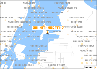
Phumĭ Thmâ Péchr (Kâmpóng Cham, Cambodia)Phumĭ Thmâ Péchr is a town in the Kâmpóng Cham region of Cambodia. An overview map of the region around Phumĭ Thmâ Péchr is displayed below.
regional and 3d topo map of Phumĭ Thmâ Péchr, Cambodia ::
Phumĭ Thmâ Péchr airports ::
The nearest airport is PNH - Phnom-penh Phnom Penh Intl, located 98.4 km south west of Phumĭ Thmâ Péchr.
Other airports nearby include SGN - Ho Chi Minh City Tansonnhat Intl (176.7 km south east), REP - Siem-reap Siem Reap (246.8 km north west), Nearby towns ::
Phumĭ Peuk (3.6km east) //
Phumĭ Chheutéal (4.1km north west) //
Phumĭ Tuŏl Kêv (5.7km west) //
Phumĭ Tuŏl Rumdéng (5.8km north) //
Phumĭ Tuŏl Pônley (6.6km south west) //
Phumĭ Tuŏl Ph'av (7.3km west) //
Phumĭ Chroŭy Kôr (7.3km east) //
Phumĭ Kâmpóng Slêng (7.6km north) //
Péam Chileăng (7.8km north west) //
Phumĭ Dâmnăk Chrey (8.3km south west) //
Phumĭ Bât Sla Slab (8.3km north west) //
Phumĭ Prâphăt (8.3km north east) //
Phumĭ Kaôh Chruk (8.1km north west) //
Phumĭ Kaôh Toch (9.1km north west) //
Phumĭ Chhuk Sândŏl (9.1km north east) //
[all distances 'as the bird flies' and approximate] 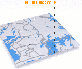 Places with similar names to Phumĭ Thmâ Péchr, Cambodia :: Disclaimer :: Information on this page comes without warranty of any kind |
||
|
Where is Phumĭ Thmâ Péchr? Elevation and coordinates ::
Latitude (lat): 12°2'0"N Longitude (lon): 105°36'0"E
Elevation (approx.): 33m (map arrows pan, magnifying glasses zoom) |
||
|
Visiting Phumĭ Thmâ Péchr? Hotel/Accommodation ::
Book a hotel in Phumĭ Thmâ Péchr Travel Guide ::
Buy a travel guide for Cambodia rental cars ::
car rental offers GPS waypoint ::
download a GPX waypoint (PoI) of Phumĭ Thmâ Péchr for your GPS receiver
|
||