|
search place name
|
||
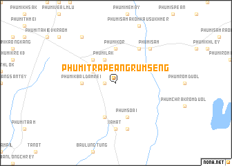
Phumĭ Trâpeăng Rumsêng (Kâmpóng Cham, Cambodia)Phumĭ Trâpeăng Rumsêng is a town in the Kâmpóng Cham region of Cambodia. An overview map of the region around Phumĭ Trâpeăng Rumsêng is displayed below.
regional and 3d topo map of Phumĭ Trâpeăng Rumsêng, Cambodia ::
Phumĭ Trâpeăng Rumsêng airports ::
The nearest airport is SGN - Ho Chi Minh City Tansonnhat Intl, located 124.7 km south east of Phumĭ Trâpeăng Rumsêng.
Other airports nearby include PNH - Phnom-penh Phnom Penh Intl (125.9 km west), Nearby towns ::
Phumĭ Preăh Phdau (1.8km west) //
Phumĭ Trâpeăng Pring (4.1km north west) //
Phumĭ L'ák (4.1km north west) //
Phumĭ Chimoăn (5.2km north west) //
Phumĭ Kbal Dâmrei (5.4km west) //
Phumĭ Kôr (5.6km north) //
Phumĭ Âmpók (5.6km north) //
Khŭm Trâpeăng Phlŏng (5.8km south) //
Phum Soai (5.8km south) //
Phumĭ Chipeăng (6.6km north east) //
Xa Mát (7.4km south) //
Bò Cây Sai (7.6km south) //
Phumĭ S'âm (7.8km north east) //
Phumĭ Krêk (9.2km north west) //
[all distances 'as the bird flies' and approximate]  Places with similar names to Phumĭ Trâpeăng Rumsêng, Cambodia :: Disclaimer :: Information on this page comes without warranty of any kind |
||
|
Where is Phumĭ Trâpeăng Rumsêng? Elevation and coordinates ::
Latitude (lat): 11°44'0"N Longitude (lon): 105°59'0"E
Elevation (approx.): 31m (map arrows pan, magnifying glasses zoom) |
||
|
Visiting Phumĭ Trâpeăng Rumsêng? Hotel/Accommodation ::
Book a hotel in Phumĭ Trâpeăng Rumsêng Travel Guide ::
Buy a travel guide for Cambodia rental cars ::
car rental offers GPS waypoint ::
download a GPX waypoint (PoI) of Phumĭ Trâpeăng Rumsêng for your GPS receiver
|
||