|
search place name
|
||
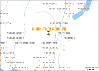
Phumĭ Tuŏl Pôngrô (Siĕm Réab, Cambodia)Phumĭ Tuŏl Pôngrô is a town in the Siĕm Réab region of Cambodia. An overview map of the region around Phumĭ Tuŏl Pôngrô is displayed below.
regional and 3d topo map of Phumĭ Tuŏl Pôngrô, Cambodia ::
Phumĭ Tuŏl Pôngrô airports ::
The nearest airport is REP - Siem-reap Siem Reap, located 59.9 km west of Phumĭ Tuŏl Pôngrô.
Other airports nearby include PNH - Phnom-penh Phnom Penh Intl (199.5 km south), PKZ - Pakse (256.3 km north east), Nearby towns ::
Phumĭ Prey Chhka (1.9km north) //
Phumĭ Prey Veăng (3.7km south) //
Phumĭ Srângê (3.6km east) //
Phumĭ Chŭb Tnaôt (4.1km south east) //
Phumĭ Ândêng Chruk (5.2km north east) //
Phumĭ Slêng Kaông (5.6km south) //
Phumĭ Trâsĕl (5.4km east) //
Phumĭ Kbal Dâmrei (6.6km south east) //
Phumĭ Thnál (7.4km south) //
Phumĭ Trâpeăng Phlŏăh (7.2km east) //
Phumĭ Mkăk (7.6km south) //
Phumĭ Svay Pôk (7.6km south) //
Phumĭ Trăng (7.4km east) //
Phumĭ Chék (7.4km east) //
Phumĭ Sâmraông (7.8km south east) //
Phumĭ Chheutéal (8.2km south east) //
Phumĭ Stœ̆ng (10.3km north east) //
Poŭthĭ Rĭng (10.3km north east) //
[all distances 'as the bird flies' and approximate] 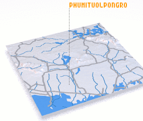 Places with similar names to Phumĭ Tuŏl Pôngrô, Cambodia ::
Disclaimer :: Information on this page comes without warranty of any kind |
||
|
Where is Phumĭ Tuŏl Pôngrô? Elevation and coordinates ::
Latitude (lat): 13°17'0"N Longitude (lon): 104°21'0"E
Elevation (approx.): 36m (map arrows pan, magnifying glasses zoom) |
||
|
Visiting Phumĭ Tuŏl Pôngrô? Hotel/Accommodation ::
Book a hotel in Phumĭ Tuŏl Pôngrô Travel Guide ::
Buy a travel guide for Cambodia rental cars ::
car rental offers GPS waypoint ::
download a GPX waypoint (PoI) of Phumĭ Tuŏl Pôngrô for your GPS receiver
|
||