|
search place name
|
||
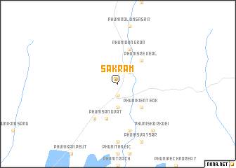
Sakram (Kâmpóng Thum, Cambodia)Sakram is a town in the Kâmpóng Thum region of Cambodia. An overview map of the region around Sakram is displayed below.
regional and 3d topo map of Sakram, Cambodia ::
Sakram airports ::
The nearest airport is REP - Siem-reap Siem Reap, located 104.6 km west of Sakram.
Other airports nearby include PNH - Phnom-penh Phnom Penh Intl (181.4 km south), PKZ - Pakse (242.7 km north east), Nearby towns ::
Phumĭ Kânsaôm Kréas (1.9km south) //
Phumĭ Kôkrŭs (1.9km south) //
Phumĭ Véal (2.6km north east) //
Phumĭ Bŏs (3.7km south) //
Phumĭ Kiĕn Teăk (5.2km south east) //
Phumĭ Srê Véal (5.2km north east) //
Phumĭ Sângvat (5.8km south) //
Phumĭ O Ângkôr (5.8km north) //
Phumĭ Chitang (6.6km south west) //
Krâya (7.6km south) //
Phumĭ Skôr Kdei (9.2km south east) //
[all distances 'as the bird flies' and approximate] 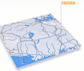 Places with similar names to Sakram, Cambodia ::
Disclaimer :: Information on this page comes without warranty of any kind |
||
|
Where is Sakram? Elevation and coordinates ::
Latitude (lat): 13°11'0"N Longitude (lon): 104°45'0"E
Elevation (approx.): 43m (map arrows pan, magnifying glasses zoom) |
||
|
Visiting Sakram? Hotel/Accommodation ::
Book a hotel in Sakram Travel Guide ::
Buy a travel guide for Cambodia rental cars ::
car rental offers GPS waypoint ::
download a GPX waypoint (PoI) of Sakram for your GPS receiver
|
||