|
search place name
|
||
Barnes Hill (Saint George, Antigua and Barbuda)Barnes Hill is a town in the Saint George region of Antigua and Barbuda. An overview map of the region around Barnes Hill is displayed below.
regional and 3d topo map of Barnes Hill, Antigua and Barbuda ::

Barnes Hill airports ::
The nearest airport is ANU - Antigua V C Bird Intl, located 1.7 km south east of Barnes Hill.
Other airports nearby include SKB - Basse Terre Robert L Bradshaw (99.3 km west), PTP - Pointe-a-pitre Le Raizet (102.0 km south), EUX - Oranjestad F D Roosevelt (131.1 km west), SFG - St. Martin Grand Case (169.0 km north west), Nearby towns ::
New Winthorpes (0.0km north) //
Osbourn (1.9km south) //
Carlisle (1.9km south) //
Cedar Valley Mill (1.9km south) //
Woods (2.6km south west) //
Cedar Grove (2.6km north west) //
Crosbies (2.6km north west) //
Cassada Gardens (3.7km south) //
Tomlinson (3.7km south) //
Gunthorpes (3.7km south) //
Piggotts (3.7km south) //
Paynters (3.7km south) //
Fitches Creek (4.1km south east) //
Sutherlands Development (4.1km south west) //
Clare Hall (4.1km south west) //
Boon House (4.0km north west) //
Weatherills (4.0km north west) //
Branns Hamlet (5.1km south west) //
Saint Johnston Village (5.1km south west) //
Gambles (5.1km south west) //
The Grove (5.6km south) //
Belmont (5.8km south) //
Vernons (6.6km south east) //
Creekside (6.6km south west) //
Golden Grove (6.6km south west) //
Green Bay (6.5km south west) //
Saint Johnʼs (6.5km south west) //
Sea View Farm (7.4km south) //
Renfrew (7.4km south) //
[all distances 'as the bird flies' and approximate] 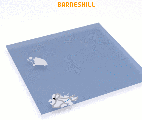 Places with similar names to Barnes Hill, Antigua and Barbuda ::
// Burunchel (ES)
// Bruyns Hill (ZA)
// Burnshill (ZA)
// Burnshill (ZA)
// Barnes Hole (US)
// Browns Hollow (US)
// Branch Hill (US)
// Browns Hill (US)
// Biron Shāl (PK)
// Browns Hall (JM)
Disclaimer :: Information on this page comes without warranty of any kind |
||
|
Where is Barnes Hill? Elevation and coordinates ::
Latitude (lat): 17°9'0"N Longitude (lon): 61°48'0"W
Elevation (approx.): 24m (map arrows pan, magnifying glasses zoom) |
||
|
Visiting Barnes Hill? Hotel/Accommodation ::
Book a hotel in Barnes Hill Travel Guide ::
rental cars ::
car rental offers GPS waypoint ::
download a GPX waypoint (PoI) of Barnes Hill for your GPS receiver
|
||