|
search place name
|
||
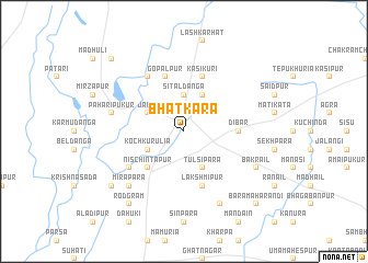
Bhātkāra (Barisāl, Bangladesh)Bhātkāra is a town in the Barisāl region of Bangladesh. An overview map of the region around Bhātkāra is displayed below.
regional and 3d topo map of Bhātkāra, Bangladesh ::
Bhātkāra airports ::
The nearest airport is RJH - Rajshahi Shah Mokhdum, located 77.3 km south of Bhātkāra.
Other airports nearby include SPD - Saidpur (77.4 km north east), IRD - Ishurdi (119.1 km south east), COH - Cooch-behar Cooch Behar (160.5 km north east), IXB - Baghdogra Bagdogra (173.1 km north), Nearby towns ::
Sitaldānga (3.7km north) //
Tulsipāra (4.1km south east) //
Koch Kurulia (3.8km south west) //
Daptali (4.1km north east) //
Jabai (3.8km north west) //
Nischintapur (5.0km south west) //
Dibar (5.0km east) //
Hāt Sāoli (5.8km north) //
Kāsikuri (5.8km north) //
Lakshmipur (5.8km south) //
Gopālpur (5.8km north) //
Goala (6.3km south west) //
Gauripur (6.5km north west) //
Pāhāri Pukur (7.0km west) //
Mirāpāra (7.5km south west) //
Bābupur (8.1km south east) //
Bākrail (7.7km south east) //
Rodgrām (9.0km south west) //
Fayzullāpur (8.7km south west) //
Bara Mahārandi (10.0km south east) //
Āihāi (10.0km north west) //
[all distances 'as the bird flies' and approximate] 
Disclaimer :: Information on this page comes without warranty of any kind |
||
|
Where is Bhātkāra? Elevation and coordinates ::
Latitude (lat): 25°8'0"N Longitude (lon): 88°34'0"E
Elevation (approx.): 33m (map arrows pan, magnifying glasses zoom) |
||
|
Visiting Bhātkāra? Hotel/Accommodation ::
Book a hotel in Bhātkāra Travel Guide ::
Buy a travel guide for Bangladesh rental cars ::
car rental offers GPS waypoint ::
download a GPX waypoint (PoI) of Bhātkāra for your GPS receiver
|
||