|
search place name
|
||
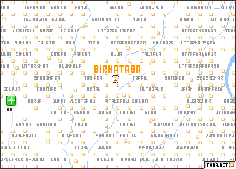
Bir Hātāba (Barisāl, Bangladesh)Bir Hātāba is a town in the Barisāl region of Bangladesh. An overview map of the region around Bir Hātāba is displayed below.
regional and 3d topo map of Bir Hātāba, Bangladesh ::
Bir Hātāba airports ::
The nearest airport is DAC - Dhaka Zia Intl, located 15.7 km west of Bir Hātāba.
Other airports nearby include IXA - Agartala (70.4 km east), IRD - Ishurdi (155.9 km west), IXH - Kailashahar (156.0 km east), JSR - Jessore (160.8 km south west), Nearby towns ::
Kāknibāg (0.0km north) //
Lakshya Manohar (0.0km north) //
Bansida (0.0km north) //
Bāghpāra (1.9km north) //
Rohila (1.9km north) //
Malibanda (1.9km north) //
Hankur (1.9km north) //
Lakshya Simulia (1.9km south) //
Debagrām (1.9km south) //
Simultala (1.9km south) //
Baildia (1.7km west) //
Bāsunda (1.7km east) //
Naogaon (1.7km west) //
Tek Dāserdia (1.7km west) //
Kālni (1.7km west) //
Tinolop (1.7km west) //
Pāiksa (1.7km east) //
Nabagrām (1.7km west) //
Bara Āmdia (1.7km west) //
Beldi (1.7km west) //
Birāba (1.9km south east) //
Pārātek (2.5km north west) //
Duāra (2.5km north east) //
Putina (2.5km north east) //
Bhāiāsuti (2.5km north west) //
Khaisār (2.5km north east) //
Agla (2.5km north east) //
Kāmālkāti (2.5km north east) //
Dāudpur (2.5km north west) //
[all distances 'as the bird flies' and approximate] 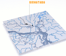 Places with similar names to Bir Hātāba, Bangladesh :: Disclaimer :: Information on this page comes without warranty of any kind |
||
|
Where is Bir Hātāba? Elevation and coordinates ::
Latitude (lat): 23°52'0"N Longitude (lon): 90°33'0"E
Elevation (approx.): 11m (map arrows pan, magnifying glasses zoom) |
||
|
Visiting Bir Hātāba? Hotel/Accommodation ::
Book a hotel in Bir Hātāba Travel Guide ::
Buy a travel guide for Bangladesh rental cars ::
car rental offers GPS waypoint ::
download a GPX waypoint (PoI) of Bir Hātāba for your GPS receiver
|
||