|
search place name
|
||
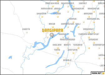
Dāngipāra (Barisāl, Bangladesh)Dāngipāra is a town in the Barisāl region of Bangladesh. An overview map of the region around Dāngipāra is displayed below.
regional and 3d topo map of Dāngipāra, Bangladesh ::
Dāngipāra airports ::
The nearest airport is SPD - Saidpur, located 78.4 km east of Dāngipāra.
Other airports nearby include IXB - Baghdogra Bagdogra (94.1 km north), BIR - Biratnagar (111.6 km north west), COH - Cooch-behar Cooch Behar (143.7 km east), RJH - Rajshahi Shah Mokhdum (163.9 km south), Nearby towns ::
Kāndhāl (1.7km west) //
Buzruk (2.5km north west) //
Bakua (3.7km north) //
Sihipur (3.3km east) //
Kholara (4.1km south east) //
Lahuchānd (5.0km east) //
Mahendragaon (5.3km east) //
Torra (5.8km south) //
Kāmārpukur (6.2km north east) //
Bahati (6.2km south east) //
Āmgaon (7.6km north) //
Lakhara (7.5km north east) //
Dhukuria (8.1km north west) //
Rāmpur (8.7km north east) //
Bhāturia (8.7km south east) //
[all distances 'as the bird flies' and approximate]  Places with similar names to Dāngipāra, Bangladesh ::
// Dānājpur (BD)
// Dinājpur (BD)
// Tangipur (BD)
// Tungipāra (BD)
// Tang-e Parī (IR)
// Tang-e Pārū (IR)
// Donja Pora (CS)
// Tingipira (SL)
Disclaimer :: Information on this page comes without warranty of any kind |
||
|
Where is Dāngipāra? Elevation and coordinates ::
Latitude (lat): 25°51'0"N Longitude (lon): 88°8'0"E
Elevation (approx.): 43m (map arrows pan, magnifying glasses zoom) |
||
|
Visiting Dāngipāra? Hotel/Accommodation ::
Book a hotel in Dāngipāra Travel Guide ::
Buy a travel guide for Bangladesh rental cars ::
car rental offers GPS waypoint ::
download a GPX waypoint (PoI) of Dāngipāra for your GPS receiver
|
||