|
search place name
|
||
Darichāndbāri (Barisāl, Bangladesh)Darichāndbāri is a town in the Barisāl region of Bangladesh. An overview map of the region around Darichāndbāri is displayed below.
regional and 3d topo map of Darichāndbāri, Bangladesh ::

Darichāndbāri airports ::
The nearest airport is DAC - Dhaka Zia Intl, located 105.1 km south east of Darichāndbāri.
Other airports nearby include IRD - Ishurdi (105.8 km south west), RJH - Rajshahi Shah Mokhdum (134.5 km west), SPD - Saidpur (156.6 km north west), IXA - Agartala (160.8 km south east), Nearby towns ::
Barni Chandbāri (3.4km east) //
Doāil (3.4km west) //
Alipur (4.1km south west) //
Pāthālia (5.0km north east) //
Islāmpur (5.1km east) //
Hādira (5.8km south) //
Kismat Dhanbāri (5.4km east) //
Kāthāliābāri (5.8km north) //
Kurulia Patal (6.3km south west) //
Dayārāmbāri (6.3km south east) //
Chāpārkona (6.3km north west) //
Māmudpur (7.0km east) //
Hāsra Mājhail (7.0km west) //
Chātutia (8.1km south west) //
Bālia (8.7km north west) //
Mulbāri (10.0km south east) //
Simla Monohar (10.0km north west) //
[all distances 'as the bird flies' and approximate] 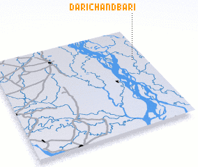 Places with similar names to Darichāndbāri, Bangladesh :: Disclaimer :: Information on this page comes without warranty of any kind |
||
|
Where is Darichāndbāri? Elevation and coordinates ::
Latitude (lat): 24°41'0"N Longitude (lon): 89°55'0"E
Elevation (approx.): 18m (map arrows pan, magnifying glasses zoom) |
||
|
Visiting Darichāndbāri? Hotel/Accommodation ::
Book a hotel in Darichāndbāri Travel Guide ::
Buy a travel guide for Bangladesh rental cars ::
car rental offers GPS waypoint ::
download a GPX waypoint (PoI) of Darichāndbāri for your GPS receiver
|
||