|
search place name
|
||
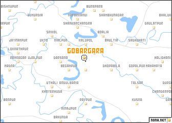
Gobargara (Barisāl, Bangladesh)Gobargara is a town in the Barisāl region of Bangladesh. An overview map of the region around Gobargara is displayed below.
regional and 3d topo map of Gobargara, Bangladesh ::
Gobargara airports ::
The nearest airport is JSR - Jessore, located 46.1 km south east of Gobargara.
Other airports nearby include IRD - Ishurdi (69.9 km north), RJH - Rajshahi Shah Mokhdum (104.7 km north), CCU - Calcutta Netaji Subhash Chandra Bose Intl (108.6 km south west), DAC - Dhaka Zia Intl (154.9 km east), Nearby towns ::
Chāndpur (1.9km south) //
Khārāgoda (2.5km north east) //
Kālupol (3.7km north) //
Begampur (3.9km south west) //
Baldia (5.0km north west) //
Dārsana (5.1km west) //
Dhopābila (5.4km east) //
Boālia (6.5km north east) //
Āndulbāria (6.5km south west) //
Niālpur (6.3km north west) //
Bhūltia (6.3km north east) //
Shankar Chandra (7.6km north) //
Uthali (8.8km south west) //
Srīkol (8.8km north west) //
Gaidghāt (8.8km north west) //
Khayerhuda (10.1km south west) //
[all distances 'as the bird flies' and approximate] 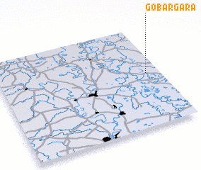 Places with similar names to Gobargara, Bangladesh ::
// Gobargāra (BD)
// Gobrakura (BD)
// Gbirikorou (BJ)
// Gober Gorou (NE)
// Kobéri Kouara (NE)
// Gberikoro (SL)
// Gbérékoro (GN)
// Gborokoro (GN)
// Gbérékoro (CI)
// Gbirikoro (CI)
Disclaimer :: Information on this page comes without warranty of any kind |
||
|
Where is Gobargara? Elevation and coordinates ::
Latitude (lat): 23°32'0"N Longitude (lon): 88°55'0"E
Elevation (approx.): 13m (map arrows pan, magnifying glasses zoom) |
||
|
Visiting Gobargara? Hotel/Accommodation ::
Book a hotel in Gobargara Travel Guide ::
Buy a travel guide for Bangladesh rental cars ::
car rental offers GPS waypoint ::
download a GPX waypoint (PoI) of Gobargara for your GPS receiver
|
||