|
search place name
|
||
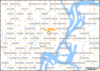
Ilamdi (Barisāl, Bangladesh)Ilamdi is a town in the Barisāl region of Bangladesh. An overview map of the region around Ilamdi is displayed below.
regional and 3d topo map of Ilamdi, Bangladesh ::
Ilamdi airports ::
The nearest airport is DAC - Dhaka Zia Intl, located 29.3 km west of Ilamdi.
Other airports nearby include IXA - Agartala (60.4 km east), IXH - Kailashahar (149.7 km north east), JSR - Jessore (166.1 km west), IRD - Ishurdi (170.5 km west), Nearby towns ::
Tilchandi (0.0km north) //
Kāmāldi (0.0km north) //
Sripati (0.0km north) //
Sripatir Chak (0.0km north) //
Bhairabdi Khās (0.0km north) //
Mānikmina (1.7km east) //
Lālmina (1.7km east) //
Rāypur (1.7km east) //
Sultān Sāhādi (1.7km east) //
Madansāhādi (1.7km east) //
Chauthāi (1.7km east) //
Kādirdia (1.7km east) //
Ātādi Khās (1.7km east) //
Uchitpur (1.7km east) //
Bhairabdi (1.7km east) //
Bājinābanda (1.7km east) //
Āligādi (1.7km east) //
Ātādi (1.7km east) //
Kājirdia (1.7km east) //
Chhota Salamdi (1.7km west) //
Kāhindi (1.7km west) //
Hājisāhādi (1.7km west) //
Rānidi (1.7km west) //
Singarpur (1.9km north) //
Singār Bil (1.9km north) //
Naikāhan (1.9km north) //
Rāmpur (1.9km south) //
Dāburpura (1.9km north) //
Latardi (1.9km north) //
[all distances 'as the bird flies' and approximate]  Places with similar names to Ilamdi, Bangladesh ::
Disclaimer :: Information on this page comes without warranty of any kind |
||
|
Where is Ilamdi? Elevation and coordinates ::
Latitude (lat): 23°45'0"N Longitude (lon): 90°40'0"E
Elevation (approx.): 9m (map arrows pan, magnifying glasses zoom) |
||
|
Visiting Ilamdi? Hotel/Accommodation ::
Book a hotel in Ilamdi Travel Guide ::
Buy a travel guide for Bangladesh rental cars ::
car rental offers GPS waypoint ::
download a GPX waypoint (PoI) of Ilamdi for your GPS receiver
|
||