|
search place name
|
||
Iyārpur (Barisāl, Bangladesh)Iyārpur is a town in the Barisāl region of Bangladesh. An overview map of the region around Iyārpur is displayed below.
regional and 3d topo map of Iyārpur, Bangladesh ::

Iyārpur airports ::
The nearest airport is RJH - Rajshahi Shah Mokhdum, located 33.8 km west of Iyārpur.
Other airports nearby include IRD - Ishurdi (43.8 km south), SPD - Saidpur (135.8 km north), JSR - Jessore (151.3 km south), DAC - Dhaka Zia Intl (167.3 km south east), Nearby towns ::
Cheukhāli (0.0km north) //
Ābdānpur (0.0km north) //
Brāhmapur (1.9km south) //
Bāngāl Khalsi (1.9km south) //
Srīrāmpur (1.9km south) //
Sarkutia (1.7km west) //
Purushottambāti (1.7km east) //
Paschim Mādhnagar (1.7km east) //
Srīpatipāra (1.9km north) //
Jagadispur Bārihāti (2.5km south west) //
Kāsiābāri (2.5km south west) //
Krishnabāti (2.5km south west) //
Konābāria (2.5km north west) //
Bil Ruhia (2.5km north east) //
Chak Sarkutia (3.4km west) //
Arjunpāra (3.4km west) //
Sekhpāra (3.7km south) //
Dhankora (3.7km south) //
Chhātārbhāg (3.7km south) //
Bhāgnadi (3.7km north) //
Nakhpāra (3.7km north) //
Sāntipur (3.7km north) //
Purba Mādhnagar (3.4km east) //
Komarpur (3.8km south west) //
Khudra Bārihāti (3.8km south west) //
Amritapāra (4.1km south west) //
Jagadispur (4.1km south west) //
Khānpur (3.8km north west) //
Bāynāpur (3.8km north west) //
[all distances 'as the bird flies' and approximate] 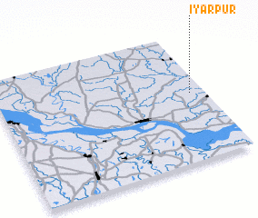 Places with similar names to Iyārpur, Bangladesh :: Disclaimer :: Information on this page comes without warranty of any kind |
||
|
Where is Iyārpur? Elevation and coordinates ::
Latitude (lat): 24°32'0"N Longitude (lon): 88°56'0"E
Elevation (approx.): 16m (map arrows pan, magnifying glasses zoom) |
||
|
Visiting Iyārpur? Hotel/Accommodation ::
Book a hotel in Iyārpur Travel Guide ::
Buy a travel guide for Bangladesh rental cars ::
car rental offers GPS waypoint ::
download a GPX waypoint (PoI) of Iyārpur for your GPS receiver
|
||