|
search place name
|
||
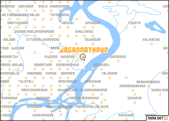
Jagannāthpur (Barisāl, Bangladesh)Jagannāthpur is a town in the Barisāl region of Bangladesh. An overview map of the region around Jagannāthpur is displayed below.
regional and 3d topo map of Jagannāthpur, Bangladesh ::
Jagannāthpur airports ::
The nearest airport is IXA - Agartala, located 31.8 km south east of Jagannāthpur.
Other airports nearby include DAC - Dhaka Zia Intl (63.8 km west), IXH - Kailashahar (107.9 km east), ZYL - Sylhet Osmani Osmany Intl (135.1 km north east), AJL - Aizwal Aizawl (188.3 km east), Nearby towns ::
Lakshmīpur (1.7km west) //
Rāmnagar (1.7km west) //
Chandiber (1.9km north) //
Gauripur (1.9km south) //
Bhairab Bāzār (2.5km north west) //
Kālipur (2.5km north east) //
Rāmsankarpur (2.5km north east) //
Char Chārtala (2.5km south east) //
Māmudābād (3.4km west) //
Mūsāpur (3.4km west) //
Krishnanagar (4.1km north west) //
Char Begamābād (4.1km south west) //
Begamābād (4.1km south west) //
Ibrāhimpur (3.9km north west) //
Pāhārkhārkāndi (3.9km south west) //
Purba Haripur (3.9km south west) //
Gochhāmāra (4.1km north east) //
Rājnagar (4.1km north east) //
Āshuganj (3.9km south east) //
Sāindhādoba (5.0km south west) //
Ānārābād (5.0km south west) //
Sāpmāra (5.0km south west) //
Kabirerkāndi (5.0km south west) //
Kukurmāra (5.1km west) //
Simul Kāndi (5.6km north) //
Madhyer Char (5.6km north) //
Jāmālpur (5.8km north) //
Bānsgāri (5.8km north) //
Saralābād (5.4km west) //
[all distances 'as the bird flies' and approximate] 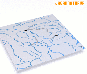 Places with similar names to Jagannāthpur, Bangladesh ::
// Jagannāthpur (BD)
// Jagannāthpur (BD)
// Jagannāthpur (BD)
// Jagannāthpur (BD)
// Jagannāthpur (BD)
// Jagannāthpur (BD)
// Jagannāthpur (BD)
// Jagannāthpur (BD)
// Jagannāthpur (BD)
// Jagannāthpur (BD)
Disclaimer :: Information on this page comes without warranty of any kind |
||
|
Where is Jagannāthpur? Elevation and coordinates ::
Latitude (lat): 24°3'0"N Longitude (lon): 90°59'0"E
Elevation (approx.): 8m (map arrows pan, magnifying glasses zoom) |
||
|
Visiting Jagannāthpur? Hotel/Accommodation ::
Book a hotel in Jagannāthpur Travel Guide ::
Buy a travel guide for Bangladesh rental cars ::
car rental offers GPS waypoint ::
download a GPX waypoint (PoI) of Jagannāthpur for your GPS receiver
|
||