|
search place name
|
||
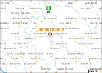
Manmathapur (Barisāl, Bangladesh)Manmathapur is a town in the Barisāl region of Bangladesh. An overview map of the region around Manmathapur is displayed below.
regional and 3d topo map of Manmathapur, Bangladesh ::
Manmathapur airports ::
The nearest airport is SPD - Saidpur, located 10.3 km north of Manmathapur.
Other airports nearby include COH - Cooch-behar Cooch Behar (91.9 km north east), IXB - Baghdogra Bagdogra (126.8 km north west), RJH - Rajshahi Shah Mokhdum (139.5 km south), IRD - Ishurdi (168.3 km south), Nearby towns ::
Rāmpur (1.9km north) //
Pārbatipur (1.9km south) //
Raghunāthpur (3.3km east) //
Nārayānpur (3.3km west) //
Chakboālia (5.0km south east) //
Belāichandi (5.6km north) //
Tājnagar (5.3km west) //
Dagārpāra (5.8km south) //
Deul (6.2km north west) //
Khiarpara (6.2km north east) //
Bāghāchora (6.5km north west) //
Hābra (7.4km south) //
Bara Chandipur (7.4km south) //
Lakshmanpur Bālāpāra (7.6km north) //
Uttar Rāmnāthpur (6.9km east) //
Khorākhāl (6.9km west) //
Gobindapur (6.9km west) //
Rādhānagar (8.7km north east) //
Uttar Salandar (8.9km south west) //
Dagarbāri (8.7km north west) //
[all distances 'as the bird flies' and approximate] 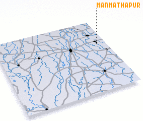 Places with similar names to Manmathapur, Bangladesh ::
// Manmathapur (BD)
Disclaimer :: Information on this page comes without warranty of any kind |
||
|
Where is Manmathapur? Elevation and coordinates ::
Latitude (lat): 25°40'0"N Longitude (lon): 88°55'0"E
Elevation (approx.): 36m (map arrows pan, magnifying glasses zoom) |
||
|
Visiting Manmathapur? Hotel/Accommodation ::
Book a hotel in Manmathapur Travel Guide ::
Buy a travel guide for Bangladesh rental cars ::
car rental offers GPS waypoint ::
download a GPX waypoint (PoI) of Manmathapur for your GPS receiver
|
||