|
search place name
|
||
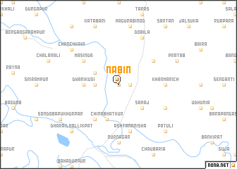
Nabin (Barisāl, Bangladesh)Nabin is a town in the Barisāl region of Bangladesh. An overview map of the region around Nabin is displayed below.
regional and 3d topo map of Nabin, Bangladesh ::
Nabin airports ::
The nearest airport is IRD - Ishurdi, located 34.1 km south west of Nabin.
Other airports nearby include RJH - Rajshahi Shah Mokhdum (73.9 km west), DAC - Dhaka Zia Intl (120.3 km south east), JSR - Jessore (126.7 km south), SPD - Saidpur (165.4 km north), Nearby towns ::
Hāndiāl (0.0km north) //
Sathal (1.9km north) //
Uttar Patiata (1.7km east) //
Chhāikola (3.4km west) //
Bīl Biāspur (3.9km north west) //
Samāj (5.0km south east) //
Dwārikusi (5.1km west) //
China Bhātkur (5.8km south) //
Pang Rauhāli (6.3km north east) //
Boālmāra (6.5km south west) //
Masinda (6.3km north west) //
Khānmarich (6.8km east) //
Ashta Manisha (7.6km south) //
Dobīla (8.1km north east) //
Purba Rāmnagar (7.7km south east) //
Chānchkair (8.7km north west) //
Dharāil Mallikpāt (10.0km south west) //
Pātuli (10.0km south east) //
[all distances 'as the bird flies' and approximate] 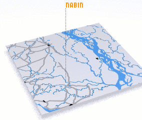 Places with similar names to Nabin, Bangladesh ::
Disclaimer :: Information on this page comes without warranty of any kind |
||
|
Where is Nabin? Elevation and coordinates ::
Latitude (lat): 24°19'0"N Longitude (lon): 89°20'0"E
Elevation (approx.): 11m (map arrows pan, magnifying glasses zoom) |
||
|
Visiting Nabin? Hotel/Accommodation ::
Book a hotel in Nabin Travel Guide ::
Buy a travel guide for Bangladesh rental cars ::
car rental offers GPS waypoint ::
download a GPX waypoint (PoI) of Nabin for your GPS receiver
|
||