|
search place name
|
||
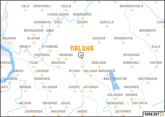
Naldha (Barisāl, Bangladesh)Naldha is a town in the Barisāl region of Bangladesh. An overview map of the region around Naldha is displayed below.
regional and 3d topo map of Naldha, Bangladesh ::
Naldha airports ::
The nearest airport is JSR - Jessore, located 72.5 km north west of Naldha.
Other airports nearby include CCU - Calcutta Netaji Subhash Chandra Bose Intl (133.1 km west), DAC - Dhaka Zia Intl (134.0 km north east), IRD - Ishurdi (165.3 km north west), IXA - Agartala (195.6 km north east), Nearby towns ::
Fakīrhāt (1.9km south) //
Maubhog (3.4km west) //
Āttāki (4.1km south west) //
Mulghar (4.1km south east) //
Goālbāri (3.9km south east) //
Diganga (5.0km north east) //
Mānsa (5.1km west) //
Bāhirdia (5.5km west) //
Bāruipāra (6.3km south east) //
Brāhman Rākdia (7.4km south) //
Gāngni (7.4km north) //
Pithābhog (7.1km west) //
Singāti (7.6km south) //
Jātrāpur (7.6km south) //
Doba (8.8km north west) //
Munizila (9.0km north east) //
Siāli (9.0km north west) //
Bhattapratāp (8.8km south east) //
Piljanga (10.1km south west) //
[all distances 'as the bird flies' and approximate] 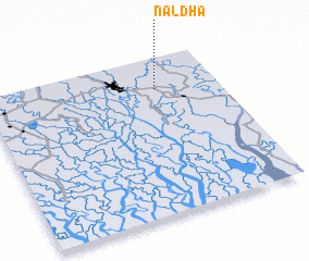
Disclaimer :: Information on this page comes without warranty of any kind |
||
|
Where is Naldha? Elevation and coordinates ::
Latitude (lat): 22°48'0"N Longitude (lon): 89°44'0"E
Elevation (approx.): 5m (map arrows pan, magnifying glasses zoom) |
||
|
Visiting Naldha? Hotel/Accommodation ::
Book a hotel in Naldha Travel Guide ::
Buy a travel guide for Bangladesh rental cars ::
car rental offers GPS waypoint ::
download a GPX waypoint (PoI) of Naldha for your GPS receiver
|
||