|
search place name
|
||
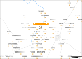
Goubougo (Benin)Goubougo is a town in Benin. An overview map of the region around Goubougo is displayed below.
regional and 3d topo map of Goubougo, Benin ::
Goubougo airports ::
The nearest airport is LRL - Niatougou Niamtougou International, located 248.5 km south west of Goubougo.
Nearby towns ::
Gona (1.9km north) //
Sanrou (1.9km north) //
Sinékparou (1.8km east) //
Toumapénou (1.8km west) //
Monko (2.6km south east) //
Birikirou (2.6km south west) //
Yayaro (2.6km south west) //
Passago (3.7km south) //
Faranguédou (4.1km north east) //
Sonmbararou (4.1km south west) //
Ouroumanga (4.1km south west) //
Youpiri (5.2km south west) //
Dodokpané (5.5km east) //
Gourou Wongouré (5.5km west) //
Niégouno (5.8km north) //
Baniniano (5.8km west) //
Tissarou (5.8km south) //
Goubou (5.8km east) //
Gandokpé (5.8km east) //
Donwari (5.8km south) //
Kongou (6.6km north east) //
Sonkparé (6.6km south east) //
Gando Ganga (6.6km south west) //
Sékaré (7.4km north) //
Diésson (7.4km north) //
Koutoubéri (7.6km north) //
Guida (7.5km east) //
Bouliniéri (7.5km west) //
Kitikagando (7.6km south) //
[all distances 'as the bird flies' and approximate] 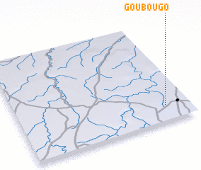 Places with similar names to Goubougo, Benin ::
Disclaimer :: Information on this page comes without warranty of any kind |
||
|
Where is Goubougo? Elevation and coordinates ::
Latitude (lat): 11°10'0"N Longitude (lon): 2°52'0"E
Elevation (approx.): 274m (map arrows pan, magnifying glasses zoom) |
||
|
Visiting Goubougo? Hotel/Accommodation ::
Book a hotel in Goubougo Travel Guide ::
Buy a travel guide for Benin rental cars ::
car rental offers GPS waypoint ::
download a GPX waypoint (PoI) of Goubougo for your GPS receiver
|
||