|
search place name
|
||
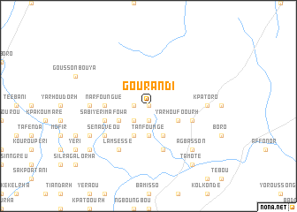
Gourandi (Benin)Gourandi is a town in Benin. An overview map of the region around Gourandi is displayed below.
regional and 3d topo map of Gourandi, Benin ::
Gourandi airports ::
The nearest airport is LRL - Niatougou Niamtougou International, located 73.3 km west of Gourandi.
Nearby towns ::
Warkouké (0.0km north) //
Gounandi (0.0km north) //
Koundjio (1.8km west) //
Yerissakou (1.9km south) //
Yarhoubarh (2.6km south west) //
Tanfoungé (3.7km south) //
Lafendi (4.1km south east) //
Yarhoufoourh (4.1km south east) //
Kourvaou-Tiakeulrhou (4.1km south west) //
Garakoursi (4.1km south west) //
Mamazoura (5.5km west) //
Narfoungué (5.5km west) //
Dalrakparou-Satieukeu (5.9km south) //
Sabiyèrimafowa (5.8km west) //
Gbangbar-Péroun (5.8km east) //
Sénagvéou (6.6km south west) //
Lamséssé (6.7km south west) //
Kpatoro (7.3km east) //
Djéssékou-Sinngreu (7.3km west) //
Kolrha (7.3km west) //
Agbasson (7.8km south east) //
Djéssékou-Sinngreu (8.2km south west) //
Sanyèrangou (9.2km south west) //
Tamoté (9.2km south east) //
[all distances 'as the bird flies' and approximate] 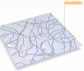 Places with similar names to Gourandi, Benin ::
Disclaimer :: Information on this page comes without warranty of any kind |
||
|
Where is Gourandi? Elevation and coordinates ::
Latitude (lat): 10°0'0"N Longitude (lon): 1°43'0"E
Elevation (approx.): 407m (map arrows pan, magnifying glasses zoom) |
||
|
Visiting Gourandi? Hotel/Accommodation ::
Book a hotel in Gourandi Travel Guide ::
Buy a travel guide for Benin rental cars ::
car rental offers GPS waypoint ::
download a GPX waypoint (PoI) of Gourandi for your GPS receiver
|
||