|
search place name
|
||
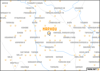
Marhou (Benin)Marhou is a town in Benin. An overview map of the region around Marhou is displayed below.
regional and 3d topo map of Marhou, Benin ::
Marhou airports ::
The nearest airport is LRL - Niatougou Niamtougou International, located 45.1 km south west of Marhou.
Nearby towns ::
Kankoulrha-Beussènnrha (1.8km east) //
Badefoourma (1.9km south) //
Kankoulrha (1.8km west) //
Fooptèlrha (2.6km south east) //
Gberniki (4.1km north east) //
Donfoourha-Tarhou (4.1km north west) //
Kankoulrha-Neumrhou (4.1km south east) //
Chabi-Kouma (4.1km north east) //
Boungou (4.1km north east) //
Bilfoourha-Kpasingreu (4.1km north west) //
Biè-Beussènnrha (4.1km south east) //
Donenga (5.2km south west) //
Sakoursi (5.6km south) //
Kankoulrha-Sinngreu (5.5km east) //
Kankiakou (5.6km north) //
Koukouloubènndi (5.8km west) //
Massi (5.9km south) //
Doningri (5.9km south) //
Kpelrhou-Kparhoutè (5.8km west) //
Anandana (5.8km west) //
Anima (6.6km north west) //
Kabatjaré (6.7km north west) //
Sakasson (6.7km north west) //
Tapoundoukounta (7.6km north) //
Foungou (7.5km west) //
Sambalrhou (7.5km east) //
Kakou (7.8km north west) //
Koutantagou (8.3km north west) //
Bilkolrha (8.3km south west) //
[all distances 'as the bird flies' and approximate] 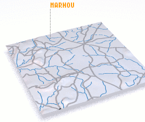 Places with similar names to Marhou, Benin ::
Disclaimer :: Information on this page comes without warranty of any kind |
||
|
Where is Marhou? Elevation and coordinates ::
Latitude (lat): 9°58'0"N Longitude (lon): 1°27'0"E
Elevation (approx.): 367m (map arrows pan, magnifying glasses zoom) |
||
|
Visiting Marhou? Hotel/Accommodation ::
Book a hotel in Marhou Travel Guide ::
Buy a travel guide for Benin rental cars ::
car rental offers GPS waypoint ::
download a GPX waypoint (PoI) of Marhou for your GPS receiver
|
||